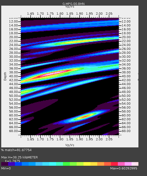
MPG Montagne des Peres, French Guyana - Earthquake Result Viewer
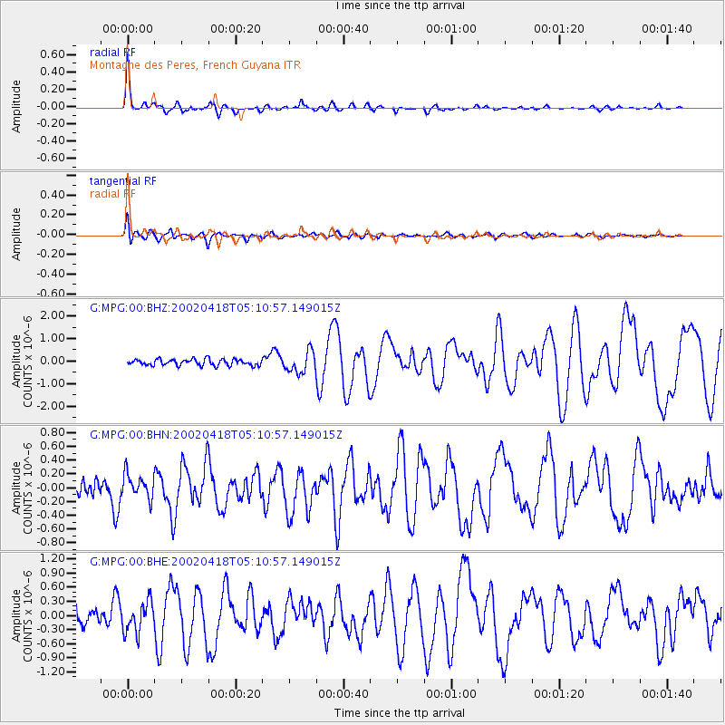
Earthquake location: Near Coast Of Guerrero, Mexico
Earthquake latitude/longitude: 17.0/-100.9
Earthquake time(UTC): 2002/04/18 (108) 05:02:46 GMT
Earthquake Depth: 25 km
Earthquake Magnitude: 5.4 MB, 6.0 MS, 6.3 MW, 6.1 MW
Earthquake Catalog/Contributor: WHDF/NEIC
Network: G GEOSCOPE
Station: MPG Montagne des Peres, French Guyana
Lat/Lon: 5.11 N/52.64 W
Elevation: 147 m
Distance: 48.6 deg
Az: 98.274 deg
Baz: 288.067 deg
Ray Param: 0.06918369
Estimated Moho Depth: 38.25 km
Estimated Crust Vp/Vs: 1.77
Assumed Crust Vp: 6.472 km/s
Estimated Crust Vs: 3.662 km/s
Estimated Crust Poisson's Ratio: 0.26
Radial Match: 91.67754 %
Radial Bump: 400
Transverse Match: 80.74391 %
Transverse Bump: 400
SOD ConfigId: 20082
Insert Time: 2010-02-26 23:34:05.282 +0000
GWidth: 2.5
Max Bumps: 400
Tol: 0.001

Signal To Noise

ChannelStoNSTALTA
G:MPG:00:BHN:20020418T05:10:57.149015Z1.22113531.7907509E-71.466464E-7
G:MPG:00:BHE:20020418T05:10:57.149015Z2.04685573.2246643E-71.5754235E-7
G:MPG:00:BHZ:20020418T05:10:57.149015Z3.41181564.771611E-71.3985549E-7
Arrivals
Ps4.8 SECOND
PpPs15 SECOND
PsPs/PpSs20 SECOND