You are here: Home > Network List > US - United States National Seismic Network Stations List
> Station ERPA Erie, Pennsylvania, USA > Earthquake Result Viewer
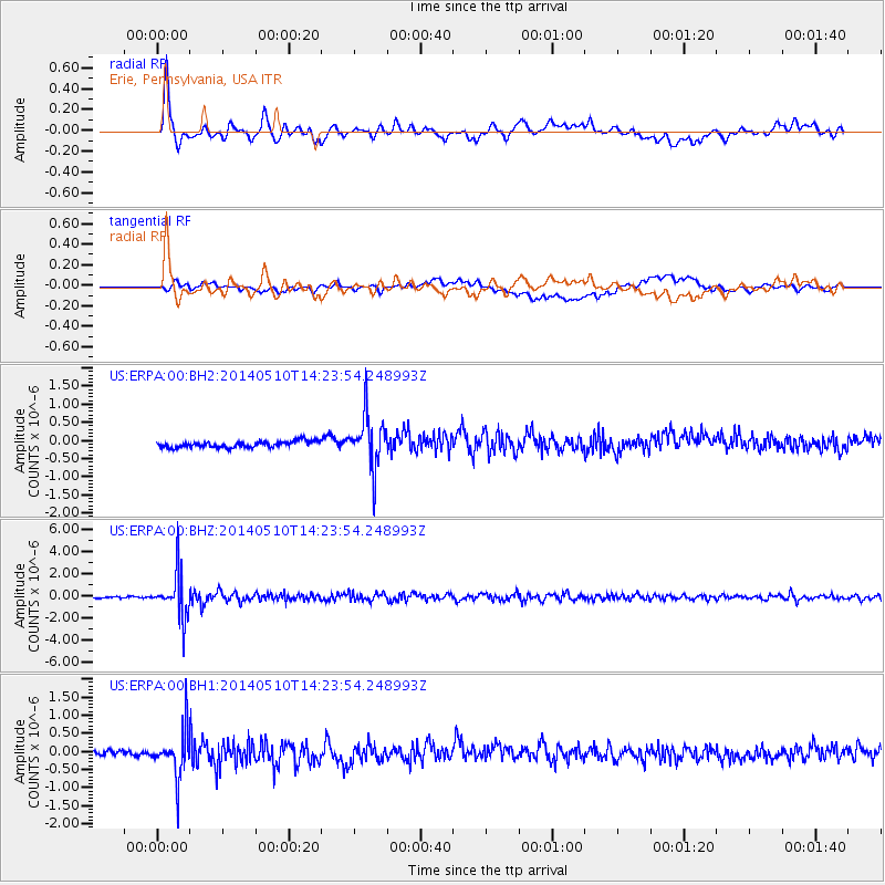
ERPA Erie, Pennsylvania, USA - Earthquake Result Viewer
*The percent match for this event was below the threshold and hence no stack was calculated.
| Earthquake location: |
Southern Alaska |
| Earthquake latitude/longitude: |
60.0/-152.2 |
| Earthquake time(UTC): |
2014/05/10 (130) 14:16:08 GMT |
| Earthquake Depth: |
96 km |
| Earthquake Magnitude: |
5.8 ML, 5.5 MI, 5.7 MWP |
| Earthquake Catalog/Contributor: |
NEIC PDE/NEIC COMCAT |
|
| Network: |
US United States National Seismic Network |
| Station: |
ERPA Erie, Pennsylvania, USA |
| Lat/Lon: |
42.12 N/79.99 W |
| Elevation: |
306 m |
|
| Distance: |
46.2 deg |
| Az: |
78.915 deg |
| Baz: |
318.496 deg |
| Ray Param: |
$rayparam |
*The percent match for this event was below the threshold and hence was not used in the summary stack. |
|
| Radial Match: |
86.05766 % |
| Radial Bump: |
400 |
| Transverse Match: |
50.56272 % |
| Transverse Bump: |
400 |
| SOD ConfigId: |
3390531 |
| Insert Time: |
2019-04-11 19:30:50.167 +0000 |
| GWidth: |
2.5 |
| Max Bumps: |
400 |
| Tol: |
0.001 |
|
Signal To Noise
| Channel | StoN | STA | LTA |
| US:ERPA:00:BHZ:20140510T14:23:54.248993Z | 21.34706 | 1.9289268E-6 | 9.03603E-8 |
| US:ERPA:00:BH1:20140510T14:23:54.248993Z | 7.7224374 | 6.545213E-7 | 8.475579E-8 |
| US:ERPA:00:BH2:20140510T14:23:54.248993Z | 8.033737 | 6.71701E-7 | 8.3610026E-8 |
| Arrivals |
| Ps | |
| PpPs | |
| PsPs/PpSs | |


