MPG Montagne des Peres, French Guyana - Earthquake Result Viewer
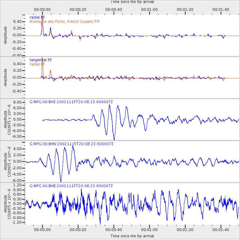
Earthquake location: South Georgia Island Region
Earthquake latitude/longitude: -56.1/-36.4
Earthquake time(UTC): 2002/11/15 (319) 19:58:31 GMT
Earthquake Depth: 10 km
Earthquake Magnitude: 6.1 MB, 6.6 MS, 6.7 MW, 6.4 MW
Earthquake Catalog/Contributor: WHDF/NEIC
Network: G GEOSCOPE
Station: MPG Montagne des Peres, French Guyana
Lat/Lon: 5.11 N/52.64 W
Elevation: 147 m
Distance: 62.4 deg
Az: 341.679 deg
Baz: 169.802 deg
Ray Param: 0.060251433
Estimated Moho Depth: 41.5 km
Estimated Crust Vp/Vs: 1.70
Assumed Crust Vp: 6.472 km/s
Estimated Crust Vs: 3.807 km/s
Estimated Crust Poisson's Ratio: 0.24
Radial Match: 97.893974 %
Radial Bump: 228
Transverse Match: 88.70684 %
Transverse Bump: 400
SOD ConfigId: 4714
Insert Time: 2010-02-26 23:34:10.707 +0000
GWidth: 2.5
Max Bumps: 400
Tol: 0.001

Signal To Noise

ChannelStoNSTALTA
G:MPG:00:BHN:20021115T20:08:23.600007Z8.7169651.2051312E-61.3825124E-7
G:MPG:00:BHE:20021115T20:08:23.600007Z0.729761961.1699938E-71.603254E-7
G:MPG:00:BHZ:20021115T20:08:23.600007Z13.28863052.786152E-62.0966434E-7
Arrivals
Ps4.7 SECOND
PpPs17 SECOND
PsPs/PpSs21 SECOND