You are here: Home > Network List > BK - Berkeley Digital Seismograph Network Stations List
> Station SAO San Andreas Geophysical Obs., Hollister, CA, USA > Earthquake Result Viewer
SAO San Andreas Geophysical Obs., Hollister, CA, USA - Earthquake Result Viewer
*The percent match for this event was below the threshold and hence no stack was calculated.
| Earthquake location: |
Peru-Bolivia Border Region |
| Earthquake latitude/longitude: |
-17.7/-69.6 |
| Earthquake time(UTC): |
2012/05/14 (135) 10:00:40 GMT |
| Earthquake Depth: |
106 km |
| Earthquake Magnitude: |
6.4 MB, 6.2 MW, 6.2 MW |
| Earthquake Catalog/Contributor: |
WHDF/NEIC |
|
| Network: |
BK Berkeley Digital Seismograph Network |
| Station: |
SAO San Andreas Geophysical Obs., Hollister, CA, USA |
| Lat/Lon: |
36.76 N/121.45 W |
| Elevation: |
317 m |
|
| Distance: |
73.0 deg |
| Az: |
318.659 deg |
| Baz: |
128.353 deg |
| Ray Param: |
$rayparam |
*The percent match for this event was below the threshold and hence was not used in the summary stack. |
|
| Radial Match: |
76.94306 % |
| Radial Bump: |
400 |
| Transverse Match: |
77.72773 % |
| Transverse Bump: |
400 |
| SOD ConfigId: |
446234 |
| Insert Time: |
2012-08-08 21:44:44.898 +0000 |
| GWidth: |
2.5 |
| Max Bumps: |
400 |
| Tol: |
0.001 |
|
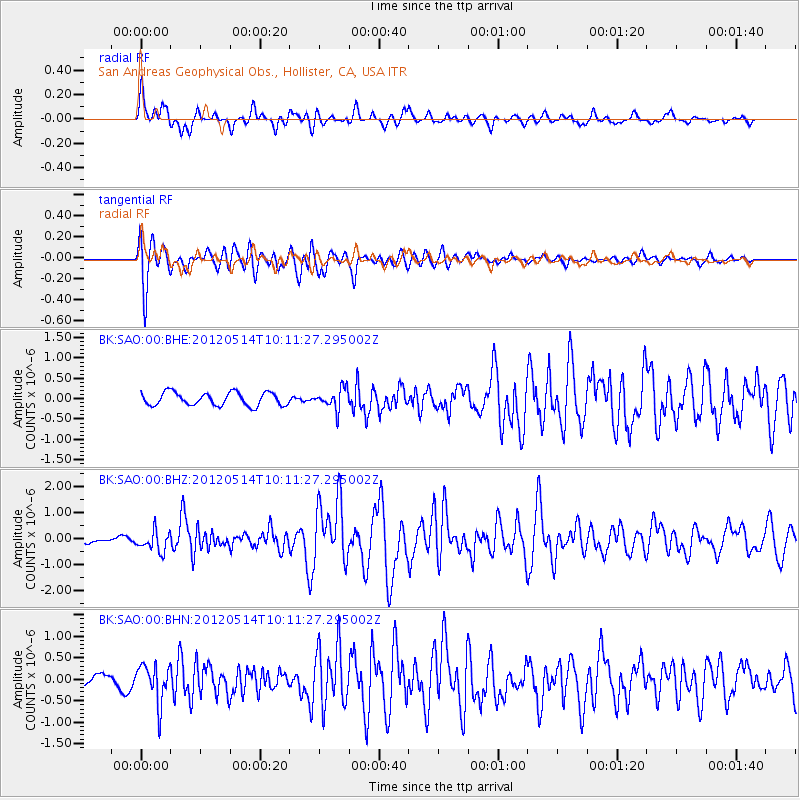
Signal To Noise
| Channel | StoN | STA | LTA |
| BK:SAO:00:BHZ:20120514T10:11:27.295002Z | 3.2970011 | 3.904329E-7 | 1.1842061E-7 |
| BK:SAO:00:BHN:20120514T10:11:27.295002Z | 2.5706081 | 4.431332E-7 | 1.7238456E-7 |
| BK:SAO:00:BHE:20120514T10:11:27.295002Z | 1.5661336 | 2.520307E-7 | 1.6092541E-7 |
| Arrivals |
| Ps | |
| PpPs | |
| PsPs/PpSs | |


