You are here: Home > Network List > CI - Caltech Regional Seismic Network Stations List
> Station SHO Shoshone, CA, USA > Earthquake Result Viewer
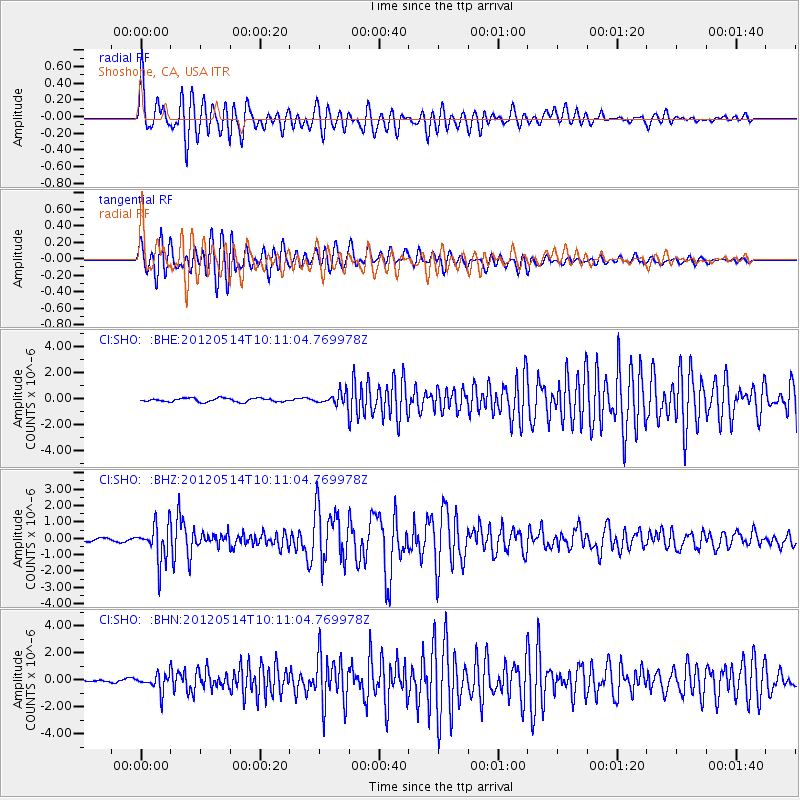
SHO Shoshone, CA, USA - Earthquake Result Viewer
*The percent match for this event was below the threshold and hence no stack was calculated.
| Earthquake location: |
Peru-Bolivia Border Region |
| Earthquake latitude/longitude: |
-17.7/-69.6 |
| Earthquake time(UTC): |
2012/05/14 (135) 10:00:40 GMT |
| Earthquake Depth: |
106 km |
| Earthquake Magnitude: |
6.4 MB, 6.2 MW, 6.2 MW |
| Earthquake Catalog/Contributor: |
WHDF/NEIC |
|
| Network: |
CI Caltech Regional Seismic Network |
| Station: |
SHO Shoshone, CA, USA |
| Lat/Lon: |
35.90 N/116.28 W |
| Elevation: |
451 m |
|
| Distance: |
69.2 deg |
| Az: |
320.814 deg |
| Baz: |
132.104 deg |
| Ray Param: |
$rayparam |
*The percent match for this event was below the threshold and hence was not used in the summary stack. |
|
| Radial Match: |
77.34003 % |
| Radial Bump: |
400 |
| Transverse Match: |
83.92826 % |
| Transverse Bump: |
400 |
| SOD ConfigId: |
446234 |
| Insert Time: |
2012-08-08 21:48:54.693 +0000 |
| GWidth: |
2.5 |
| Max Bumps: |
400 |
| Tol: |
0.001 |
|
Signal To Noise
| Channel | StoN | STA | LTA |
| CI:SHO: :BHZ:20120514T10:11:04.769978Z | 12.369513 | 1.1149853E-6 | 9.013979E-8 |
| CI:SHO: :BHN:20120514T10:11:04.769978Z | 7.359112 | 6.445993E-7 | 8.7592E-8 |
| CI:SHO: :BHE:20120514T10:11:04.769978Z | 3.3096123 | 4.654804E-7 | 1.40645E-7 |
| Arrivals |
| Ps | |
| PpPs | |
| PsPs/PpSs | |


