You are here: Home > Network List > G - GEOSCOPE Stations List
> Station MPG Montagne des Peres, French Guyana > Earthquake Result Viewer
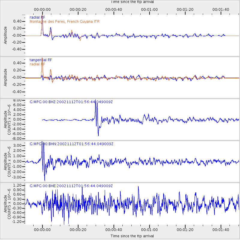
MPG Montagne des Peres, French Guyana - Earthquake Result Viewer

| Earthquake location: |
South Sandwich Islands Region |
| Earthquake latitude/longitude: |
-56.5/-27.5 |
| Earthquake time(UTC): |
2002/11/12 (316) 01:46:48 GMT |
| Earthquake Depth: |
120 km |
| Earthquake Magnitude: |
6.0 MB, 6.3 MW, 6.2 MW |
| Earthquake Catalog/Contributor: |
WHDF/NEIC |
|
| Network: |
G GEOSCOPE |
| Station: |
MPG Montagne des Peres, French Guyana |
| Lat/Lon: |
5.11 N/52.64 W |
| Elevation: |
147 m |
|
| Distance: |
64.8 deg |
| Az: |
332.152 deg |
| Baz: |
164.947 deg |
| Ray Param: |
0.05836009 |
| Estimated Moho Depth: |
42.0 km |
| Estimated Crust Vp/Vs: |
1.69 |
| Assumed Crust Vp: |
6.472 km/s |
| Estimated Crust Vs: |
3.824 km/s |
| Estimated Crust Poisson's Ratio: |
0.23 |
|
| Radial Match: |
90.5746 % |
| Radial Bump: |
400 |
| Transverse Match: |
76.747284 % |
| Transverse Bump: |
400 |
| SOD ConfigId: |
4714 |
| Insert Time: |
2010-02-26 23:34:22.870 +0000 |
| GWidth: |
2.5 |
| Max Bumps: |
400 |
| Tol: |
0.001 |
|
Signal To Noise
| Channel | StoN | STA | LTA |
| G:MPG:00:BHN:20021112T01:56:44.049009Z | 14.658874 | 1.5867798E-6 | 1.0824705E-7 |
| G:MPG:00:BHE:20021112T01:56:44.049009Z | 2.8445382 | 3.3147373E-7 | 1.1652989E-7 |
| G:MPG:00:BHZ:20021112T01:56:44.049009Z | 22.825375 | 3.3541448E-6 | 1.4694807E-7 |
| Arrivals |
| Ps | 4.7 SECOND |
| PpPs | 17 SECOND |
| PsPs/PpSs | 21 SECOND |


