
MPG Montagne des Peres, French Guyana - Earthquake Result Viewer
| ||||||||||||||||||
| ||||||||||||||||||
| ||||||||||||||||||
|
Signal To Noise
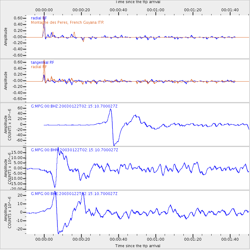
| Channel | StoN | STA | LTA |
| G:MPG:00:BHN:20030122T02:15:10.700027Z | 20.702116 | 4.3760906E-6 | 2.1138372E-7 |
| G:MPG:00:BHE:20030122T02:15:10.700027Z | 38.88903 | 6.335045E-6 | 1.6290056E-7 |
| G:MPG:00:BHZ:20030122T02:15:10.700027Z | 46.805244 | 1.3560806E-5 | 2.8972835E-7 |
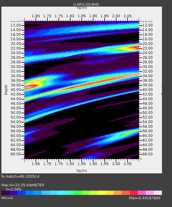
| Arrivals | |
| Ps | 5.8 SECOND |
| PpPs | 15 SECOND |
| PsPs/PpSs | 21 SECOND |

