
MPG Montagne des Peres, French Guyana - Earthquake Result Viewer
| ||||||||||||||||||
| ||||||||||||||||||
| ||||||||||||||||||
|
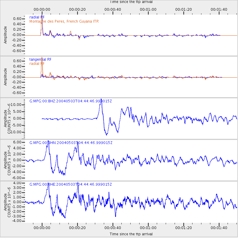
Signal To Noise
| Channel | StoN | STA | LTA |
| G:MPG:00:BHN:20040503T04:44:46.999015Z | 17.912186 | 3.0452848E-6 | 1.700119E-7 |
| G:MPG:00:BHE:20040503T04:44:46.999015Z | 11.176086 | 1.8326799E-6 | 1.6398225E-7 |
| G:MPG:00:BHZ:20040503T04:44:46.999015Z | 22.530024 | 6.691122E-6 | 2.969869E-7 |
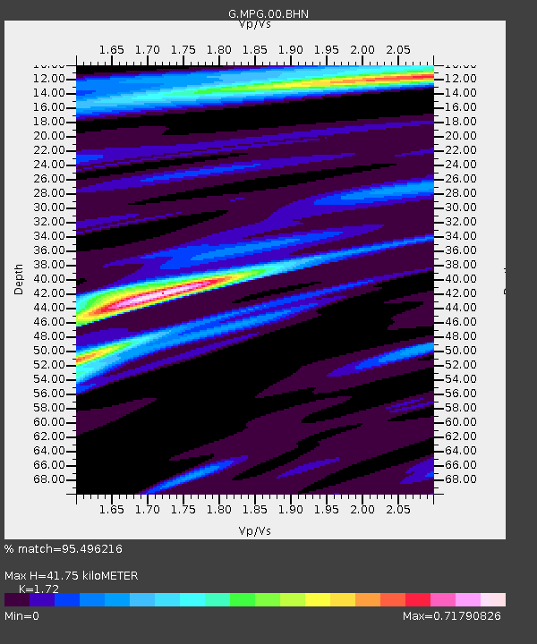
| Arrivals | |
| Ps | 5.0 SECOND |
| PpPs | 16 SECOND |
| PsPs/PpSs | 21 SECOND |

