MPG Montagne des Peres, French Guyana - Earthquake Result Viewer
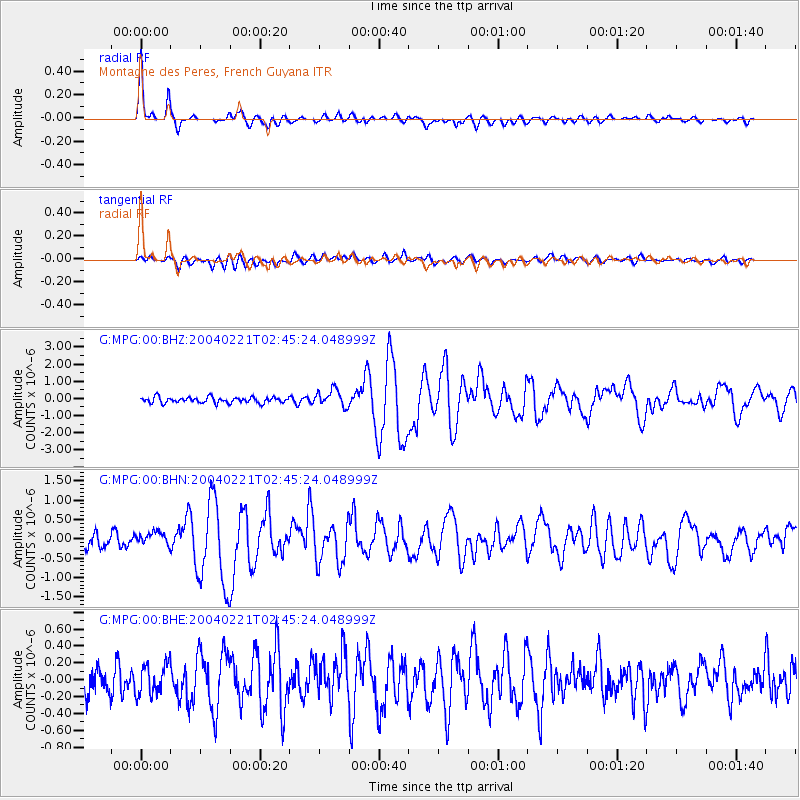
Earthquake location: Southwestern Atlantic Ocean
Earthquake latitude/longitude: -58.4/-15.0
Earthquake time(UTC): 2004/02/21 (052) 02:34:42 GMT
Earthquake Depth: 10 km
Earthquake Magnitude: 6.0 MB, 6.5 MS, 6.6 MW, 6.6 MW
Earthquake Catalog/Contributor: WHDF/NEIC
Network: G GEOSCOPE
Station: MPG Montagne des Peres, French Guyana
Lat/Lon: 5.11 N/52.64 W
Elevation: 147 m
Distance: 70.2 deg
Az: 319.66 deg
Baz: 160.005 deg
Ray Param: 0.055173684
Estimated Moho Depth: 42.0 km
Estimated Crust Vp/Vs: 1.70
Assumed Crust Vp: 6.472 km/s
Estimated Crust Vs: 3.818 km/s
Estimated Crust Poisson's Ratio: 0.23
Radial Match: 95.42897 %
Radial Bump: 400
Transverse Match: 69.97 %
Transverse Bump: 400
SOD ConfigId: 2459
Insert Time: 2010-02-26 23:34:38.700 +0000
GWidth: 2.5
Max Bumps: 400
Tol: 0.001

Signal To Noise

ChannelStoNSTALTA
G:MPG:00:BHN:20040221T02:45:24.048999Z1.03721851.5940545E-71.536855E-7
G:MPG:00:BHE:20040221T02:45:24.048999Z1.37565351.8111228E-71.3165545E-7
G:MPG:00:BHZ:20040221T02:45:24.048999Z2.91235074.871294E-71.672633E-7
Arrivals
Ps4.7 SECOND
PpPs17 SECOND
PsPs/PpSs22 SECOND