You are here: Home > Network List > TA - USArray Transportable Network (new EarthScope stations) Stations List
> Station I03D Drain, OR, USA > Earthquake Result Viewer
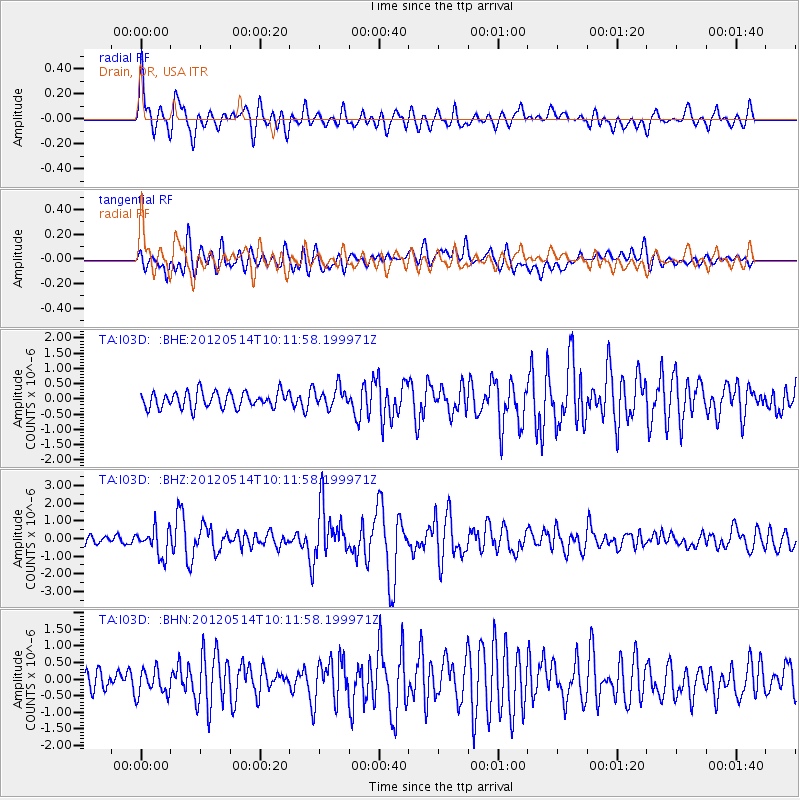
I03D Drain, OR, USA - Earthquake Result Viewer
*The percent match for this event was below the threshold and hence no stack was calculated.
| Earthquake location: |
Peru-Bolivia Border Region |
| Earthquake latitude/longitude: |
-17.7/-69.6 |
| Earthquake time(UTC): |
2012/05/14 (135) 10:00:40 GMT |
| Earthquake Depth: |
106 km |
| Earthquake Magnitude: |
6.4 MB, 6.2 MW, 6.2 MW |
| Earthquake Catalog/Contributor: |
WHDF/NEIC |
|
| Network: |
TA USArray Transportable Network (new EarthScope stations) |
| Station: |
I03D Drain, OR, USA |
| Lat/Lon: |
43.70 N/123.35 W |
| Elevation: |
140 m |
|
| Distance: |
78.4 deg |
| Az: |
323.332 deg |
| Baz: |
128.285 deg |
| Ray Param: |
$rayparam |
*The percent match for this event was below the threshold and hence was not used in the summary stack. |
|
| Radial Match: |
74.23515 % |
| Radial Bump: |
400 |
| Transverse Match: |
68.32977 % |
| Transverse Bump: |
400 |
| SOD ConfigId: |
446234 |
| Insert Time: |
2012-08-08 22:11:35.161 +0000 |
| GWidth: |
2.5 |
| Max Bumps: |
400 |
| Tol: |
0.001 |
|
Signal To Noise
| Channel | StoN | STA | LTA |
| TA:I03D: :BHZ:20120514T10:11:58.199971Z | 1.9560142 | 7.8237065E-7 | 3.999821E-7 |
| TA:I03D: :BHN:20120514T10:11:58.199971Z | 1.3749087 | 3.8796873E-7 | 2.821778E-7 |
| TA:I03D: :BHE:20120514T10:11:58.199971Z | 1.2609067 | 3.280973E-7 | 2.6020743E-7 |
| Arrivals |
| Ps | |
| PpPs | |
| PsPs/PpSs | |


