You are here: Home > Network List > TA - USArray Transportable Network (new EarthScope stations) Stations List
> Station N02D Trinity Center, CA, USA > Earthquake Result Viewer
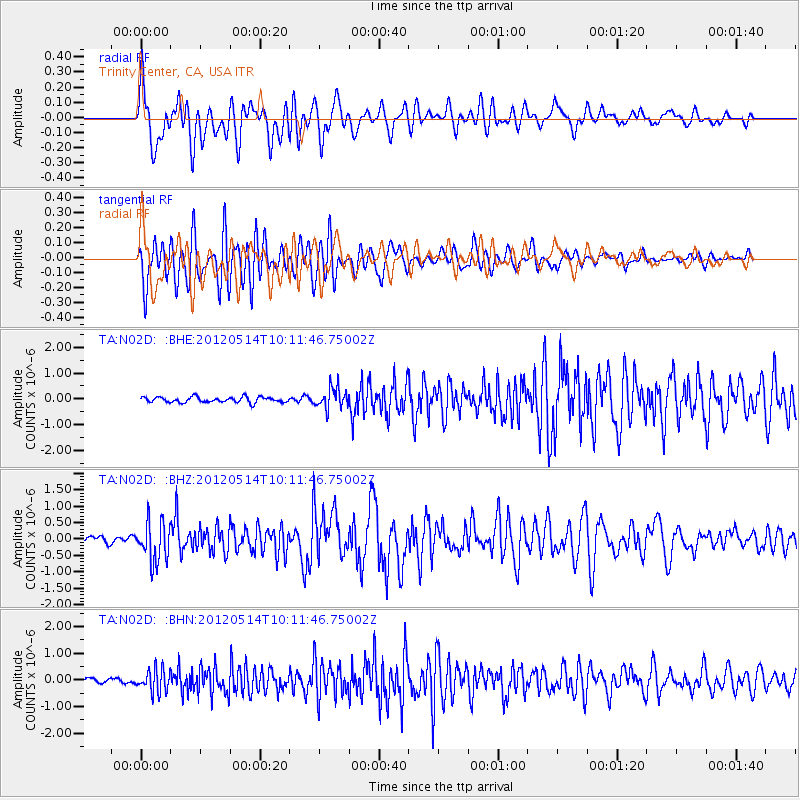
N02D Trinity Center, CA, USA - Earthquake Result Viewer
*The percent match for this event was below the threshold and hence no stack was calculated.
| Earthquake location: |
Peru-Bolivia Border Region |
| Earthquake latitude/longitude: |
-17.7/-69.6 |
| Earthquake time(UTC): |
2012/05/14 (135) 10:00:40 GMT |
| Earthquake Depth: |
106 km |
| Earthquake Magnitude: |
6.4 MB, 6.2 MW, 6.2 MW |
| Earthquake Catalog/Contributor: |
WHDF/NEIC |
|
| Network: |
TA USArray Transportable Network (new EarthScope stations) |
| Station: |
N02D Trinity Center, CA, USA |
| Lat/Lon: |
40.97 N/122.71 W |
| Elevation: |
937 m |
|
| Distance: |
76.3 deg |
| Az: |
321.447 deg |
| Baz: |
128.305 deg |
| Ray Param: |
$rayparam |
*The percent match for this event was below the threshold and hence was not used in the summary stack. |
|
| Radial Match: |
51.755127 % |
| Radial Bump: |
400 |
| Transverse Match: |
70.36988 % |
| Transverse Bump: |
400 |
| SOD ConfigId: |
446234 |
| Insert Time: |
2012-08-08 22:11:44.115 +0000 |
| GWidth: |
2.5 |
| Max Bumps: |
400 |
| Tol: |
0.001 |
|
Signal To Noise
| Channel | StoN | STA | LTA |
| TA:N02D: :BHZ:20120514T10:11:46.75002Z | 4.5562153 | 6.08795E-7 | 1.3361858E-7 |
| TA:N02D: :BHN:20120514T10:11:46.75002Z | 4.624809 | 4.1519488E-7 | 8.9775575E-8 |
| TA:N02D: :BHE:20120514T10:11:46.75002Z | 3.729015 | 3.9411668E-7 | 1.0568922E-7 |
| Arrivals |
| Ps | |
| PpPs | |
| PsPs/PpSs | |


