You are here: Home > Network List > G - GEOSCOPE Stations List
> Station NOUC Port Laguerre, New Caledonia > Earthquake Result Viewer
NOUC Port Laguerre, New Caledonia - Earthquake Result Viewer

| Earthquake location: |
South Of Mariana Islands |
| Earthquake latitude/longitude: |
11.8/144.8 |
| Earthquake time(UTC): |
2000/12/19 (354) 13:11:47 GMT |
| Earthquake Depth: |
33 km |
| Earthquake Magnitude: |
6.3 MB, 5.8 MS, 6.2 MW, 6.2 MW |
| Earthquake Catalog/Contributor: |
WHDF/NEIC |
|
| Network: |
G GEOSCOPE |
| Station: |
NOUC Port Laguerre, New Caledonia |
| Lat/Lon: |
22.10 S/166.30 E |
| Elevation: |
112 m |
|
| Distance: |
39.7 deg |
| Az: |
147.815 deg |
| Baz: |
325.775 deg |
| Ray Param: |
0.0747426 |
| Estimated Moho Depth: |
12.0 km |
| Estimated Crust Vp/Vs: |
2.09 |
| Assumed Crust Vp: |
5.14 km/s |
| Estimated Crust Vs: |
2.456 km/s |
| Estimated Crust Poisson's Ratio: |
0.35 |
|
| Radial Match: |
83.49378 % |
| Radial Bump: |
392 |
| Transverse Match: |
81.49105 % |
| Transverse Bump: |
400 |
| SOD ConfigId: |
20082 |
| Insert Time: |
2010-02-26 23:34:54.486 +0000 |
| GWidth: |
2.5 |
| Max Bumps: |
400 |
| Tol: |
0.001 |
|
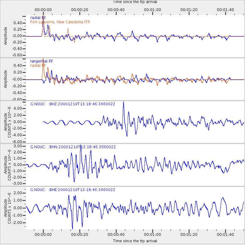
Signal To Noise
| Channel | StoN | STA | LTA |
| G:NOUC: :BHN:20001219T13:18:46.366002Z | 0.9868301 | 2.5188857E-7 | 2.552502E-7 |
| G:NOUC: :BHE:20001219T13:18:46.366002Z | 1.0983522 | 3.0089927E-7 | 2.7395518E-7 |
| G:NOUC: :BHZ:20001219T13:18:46.366002Z | 1.7180831 | 6.776007E-7 | 3.9439342E-7 |
| Arrivals |
| Ps | 2.6 SECOND |
| PpPs | 7.0 SECOND |
| PsPs/PpSs | 9.6 SECOND |


