NOUC Port Laguerre, New Caledonia - Earthquake Result Viewer
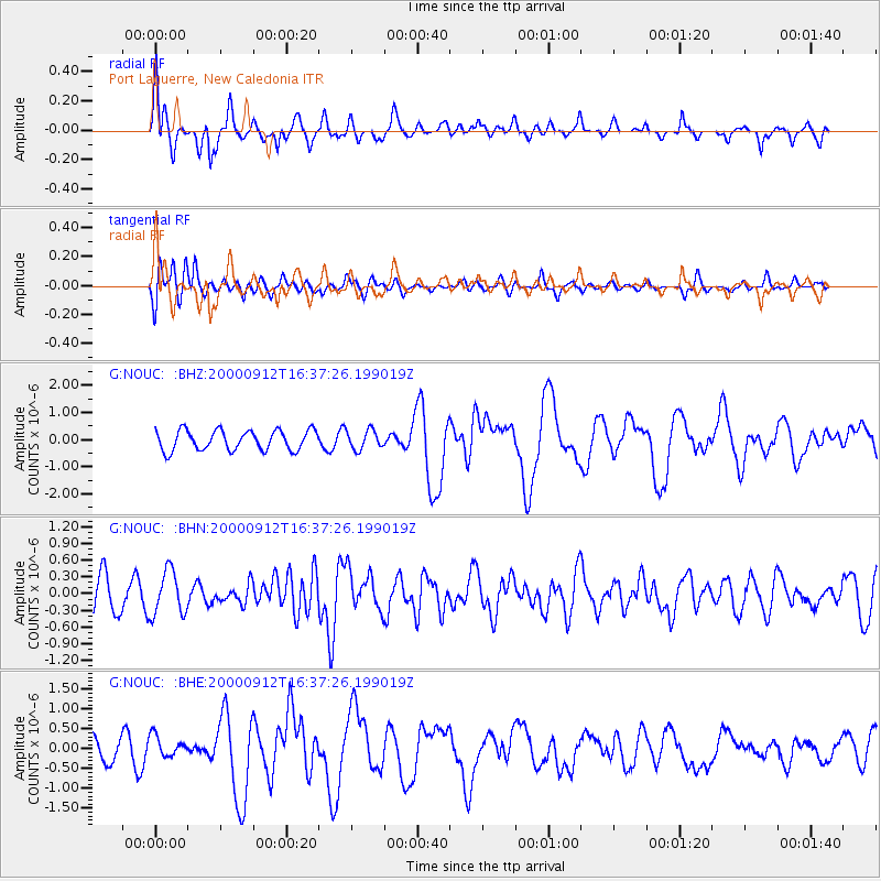
Earthquake location: Southwest Of Sumatra, Indonesia
Earthquake latitude/longitude: -5.4/101.8
Earthquake time(UTC): 2000/09/12 (256) 16:27:24 GMT
Earthquake Depth: 33 km
Earthquake Magnitude: 5.7 MB, 6.1 MS, 6.0 MW, 5.9 MW
Earthquake Catalog/Contributor: WHDF/NEIC
Network: G GEOSCOPE
Station: NOUC Port Laguerre, New Caledonia
Lat/Lon: 22.10 S/166.30 E
Elevation: 112 m
Distance: 64.3 deg
Az: 111.805 deg
Baz: 274.657 deg
Ray Param: 0.058929905
Estimated Moho Depth: 67.0 km
Estimated Crust Vp/Vs: 1.84
Assumed Crust Vp: 5.14 km/s
Estimated Crust Vs: 2.793 km/s
Estimated Crust Poisson's Ratio: 0.29
Radial Match: 88.3989 %
Radial Bump: 400
Transverse Match: 60.701576 %
Transverse Bump: 400
SOD ConfigId: 3744
Insert Time: 2010-02-26 23:34:58.198 +0000
GWidth: 2.5
Max Bumps: 400
Tol: 0.001

Signal To Noise

ChannelStoNSTALTA
G:NOUC: :BHN:20000912T16:37:26.199019Z1.03666083.9364556E-73.7972453E-7
G:NOUC: :BHE:20000912T16:37:26.199019Z0.90770912.6493333E-72.918703E-7
G:NOUC: :BHZ:20000912T16:37:26.199019Z0.97103253.5554038E-73.6614674E-7
Arrivals
Ps11 SECOND
PpPs36 SECOND
PsPs/PpSs47 SECOND