NOUC Port Laguerre, New Caledonia - Earthquake Result Viewer
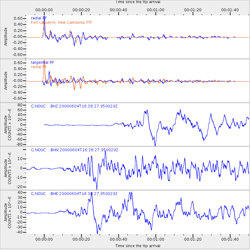
Earthquake location: Southern Sumatra, Indonesia
Earthquake latitude/longitude: -4.7/102.1
Earthquake time(UTC): 2000/06/04 (156) 16:28:26 GMT
Earthquake Depth: 33 km
Earthquake Magnitude: 6.8 MB, 8.0 MS, 7.9 MW, 7.7 MW
Earthquake Catalog/Contributor: WHDF/NEIC
Network: G GEOSCOPE
Station: NOUC Port Laguerre, New Caledonia
Lat/Lon: 22.10 S/166.30 E
Elevation: 112 m
Distance: 64.4 deg
Az: 112.145 deg
Baz: 275.496 deg
Ray Param: 0.058916133
Estimated Moho Depth: 24.75 km
Estimated Crust Vp/Vs: 2.09
Assumed Crust Vp: 5.14 km/s
Estimated Crust Vs: 2.456 km/s
Estimated Crust Poisson's Ratio: 0.35
Radial Match: 95.77772 %
Radial Bump: 400
Transverse Match: 85.27076 %
Transverse Bump: 400
SOD ConfigId: 3744
Insert Time: 2010-02-26 23:35:08.034 +0000
GWidth: 2.5
Max Bumps: 400
Tol: 0.001

Signal To Noise

ChannelStoNSTALTA
G:NOUC: :BHN:20000604T16:38:27.950029Z0.410132054.052496E-79.880955E-7
G:NOUC: :BHE:20000604T16:38:27.950029Z1.37866756.6412883E-74.8171796E-7
G:NOUC: :BHZ:20000604T16:38:27.950029Z1.83409011.3815932E-67.5328535E-7
Arrivals
Ps5.4 SECOND
PpPs15 SECOND
PsPs/PpSs20 SECOND