
NOUC Port Laguerre, New Caledonia - Earthquake Result Viewer
| ||||||||||||||||||
| ||||||||||||||||||
| ||||||||||||||||||
|
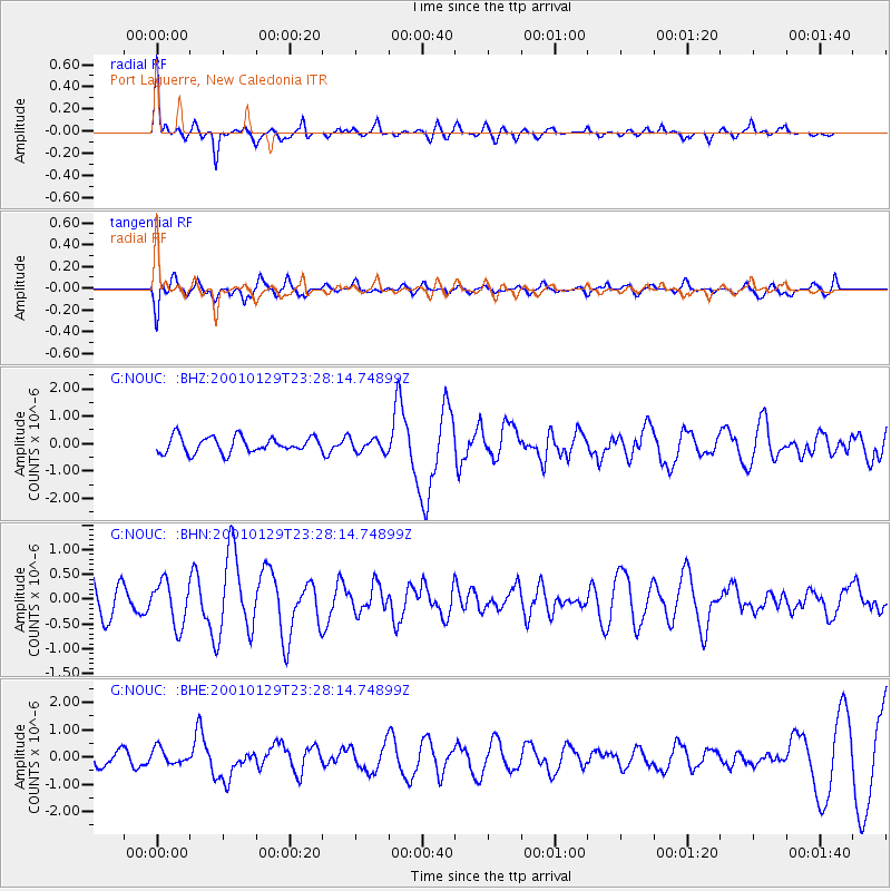
Signal To Noise
| Channel | StoN | STA | LTA |
| G:NOUC: :BHN:20010129T23:28:14.74899Z | 1.3572942 | 4.4544697E-7 | 3.2818747E-7 |
| G:NOUC: :BHE:20010129T23:28:14.74899Z | 1.2099433 | 2.8506335E-7 | 2.356006E-7 |
| G:NOUC: :BHZ:20010129T23:28:14.74899Z | 0.8355245 | 2.3901984E-7 | 2.8607164E-7 |
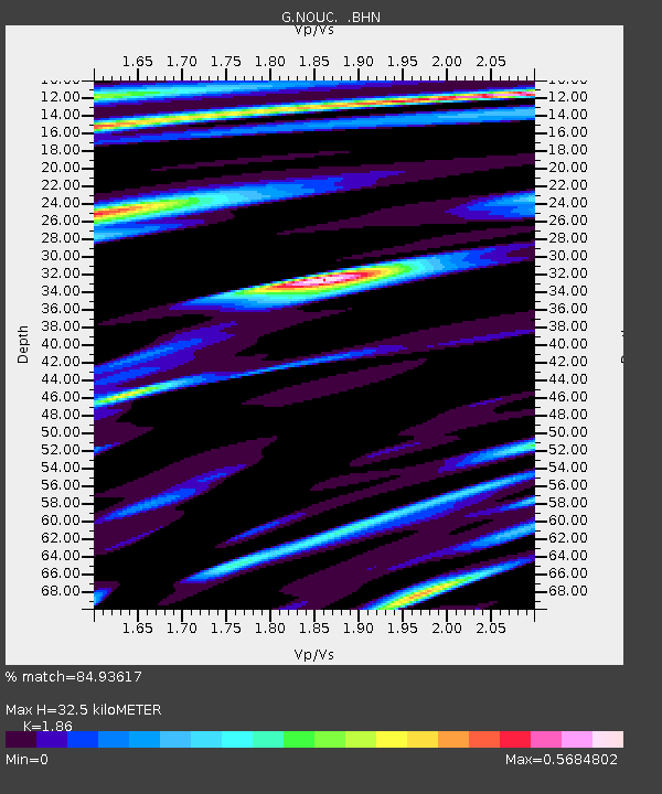
| Arrivals | |
| Ps | 5.7 SECOND |
| PpPs | 17 SECOND |
| PsPs/PpSs | 23 SECOND |

