NOUC Port Laguerre, New Caledonia - Earthquake Result Viewer
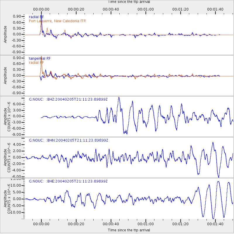
Earthquake location: Irian Jaya Region, Indonesia
Earthquake latitude/longitude: -3.6/135.5
Earthquake time(UTC): 2004/02/05 (036) 21:05:02 GMT
Earthquake Depth: 17 km
Earthquake Magnitude: 6.1 MB, 7.1 MS, 7.0 MW, 6.8 MW
Earthquake Catalog/Contributor: WHDF/NEIC
Network: G GEOSCOPE
Station: NOUC Port Laguerre, New Caledonia
Lat/Lon: 22.10 S/166.30 E
Elevation: 112 m
Distance: 35.0 deg
Az: 124.286 deg
Baz: 297.231 deg
Ray Param: 0.077414975
Estimated Moho Depth: 44.0 km
Estimated Crust Vp/Vs: 1.63
Assumed Crust Vp: 5.14 km/s
Estimated Crust Vs: 3.158 km/s
Estimated Crust Poisson's Ratio: 0.20
Radial Match: 90.77879 %
Radial Bump: 264
Transverse Match: 85.64448 %
Transverse Bump: 400
SOD ConfigId: 2459
Insert Time: 2010-02-26 23:35:44.186 +0000
GWidth: 2.5
Max Bumps: 400
Tol: 0.001

Signal To Noise

ChannelStoNSTALTA
G:NOUC: :BHN:20040205T21:11:23.89899Z1.34663073.2566606E-72.4183768E-7
G:NOUC: :BHE:20040205T21:11:23.89899Z2.39158497.505623E-73.1383468E-7
G:NOUC: :BHZ:20040205T21:11:23.89899Z4.8724141.3473249E-62.76521E-7
Arrivals
Ps5.7 SECOND
PpPs21 SECOND
PsPs/PpSs27 SECOND