NOUC Port Laguerre, New Caledonia - Earthquake Result Viewer
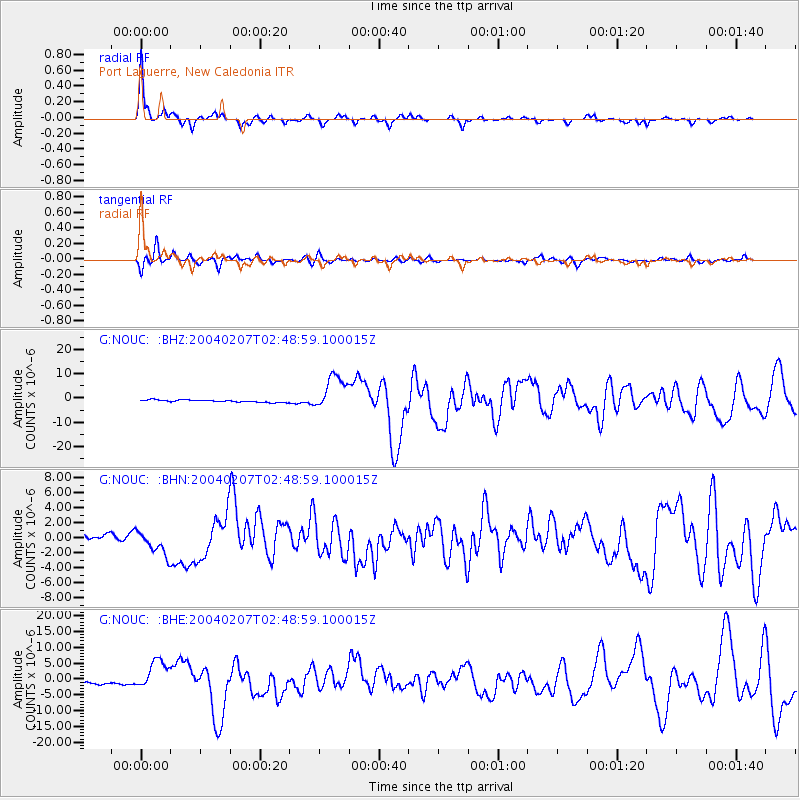
Earthquake location: Irian Jaya Region, Indonesia
Earthquake latitude/longitude: -4.0/135.0
Earthquake time(UTC): 2004/02/07 (038) 02:42:35 GMT
Earthquake Depth: 10 km
Earthquake Magnitude: 6.2 MB, 7.5 MS, 7.3 MW, 7.3 MW
Earthquake Catalog/Contributor: WHDF/NEIC
Network: G GEOSCOPE
Station: NOUC Port Laguerre, New Caledonia
Lat/Lon: 22.10 S/166.30 E
Elevation: 112 m
Distance: 35.3 deg
Az: 123.459 deg
Baz: 296.178 deg
Ray Param: 0.07732093
Estimated Moho Depth: 24.0 km
Estimated Crust Vp/Vs: 1.85
Assumed Crust Vp: 5.14 km/s
Estimated Crust Vs: 2.782 km/s
Estimated Crust Poisson's Ratio: 0.29
Radial Match: 91.11106 %
Radial Bump: 279
Transverse Match: 77.81994 %
Transverse Bump: 400
SOD ConfigId: 2459
Insert Time: 2010-02-26 23:35:45.590 +0000
GWidth: 2.5
Max Bumps: 400
Tol: 0.001

Signal To Noise

ChannelStoNSTALTA
G:NOUC: :BHN:20040207T02:48:59.100015Z5.6586611.6836535E-62.9753568E-7
G:NOUC: :BHE:20040207T02:48:59.100015Z12.9953064.8471074E-63.7298912E-7
G:NOUC: :BHZ:20040207T02:48:59.100015Z15.9827.306216E-64.571528E-7
Arrivals
Ps4.1 SECOND
PpPs13 SECOND
PsPs/PpSs17 SECOND