
NOUC Port Laguerre, New Caledonia - Earthquake Result Viewer
| ||||||||||||||||||
| ||||||||||||||||||
| ||||||||||||||||||
|
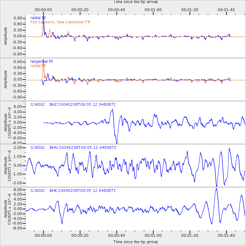
Signal To Noise
| Channel | StoN | STA | LTA |
| G:NOUC: :BHN:20040208T09:05:12.948987Z | 0.28328675 | 1.2358443E-7 | 4.3625207E-7 |
| G:NOUC: :BHE:20040208T09:05:12.948987Z | 2.4335608 | 6.085867E-7 | 2.5008075E-7 |
| G:NOUC: :BHZ:20040208T09:05:12.948987Z | 2.078104 | 6.560303E-7 | 3.1568692E-7 |
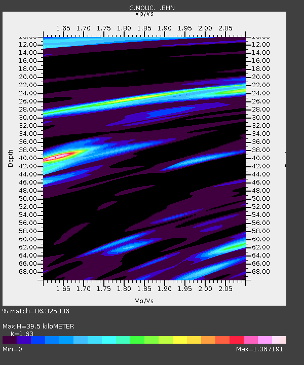
| Arrivals | |
| Ps | 5.1 SECOND |
| PpPs | 19 SECOND |
| PsPs/PpSs | 24 SECOND |

