NOUC Port Laguerre, New Caledonia - Earthquake Result Viewer
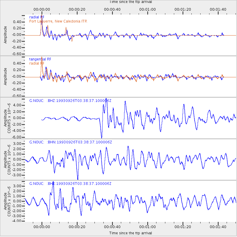
Earthquake location: W. Caroline Islands, Micronesia
Earthquake latitude/longitude: 10.0/138.2
Earthquake time(UTC): 1993/09/26 (269) 03:31:18 GMT
Earthquake Depth: 33 km
Earthquake Magnitude: 6.1 MB, 6.0 MS, 5.9 UNKNOWN, 6.4 MW
Earthquake Catalog/Contributor: WHDF/NEIC
Network: G GEOSCOPE
Station: NOUC Port Laguerre, New Caledonia
Lat/Lon: 22.10 S/166.30 E
Elevation: 112 m
Distance: 42.2 deg
Az: 139.341 deg
Baz: 316.207 deg
Ray Param: 0.07325885
Estimated Moho Depth: 13.25 km
Estimated Crust Vp/Vs: 2.10
Assumed Crust Vp: 5.14 km/s
Estimated Crust Vs: 2.451 km/s
Estimated Crust Poisson's Ratio: 0.35
Radial Match: 85.99114 %
Radial Bump: 400
Transverse Match: 84.33221 %
Transverse Bump: 400
SOD ConfigId: 16938
Insert Time: 2010-02-26 23:36:05.373 +0000
GWidth: 2.5
Max Bumps: 400
Tol: 0.001

Signal To Noise

ChannelStoNSTALTA
G:NOUC: :BHN:19930926T03:38:37.100006Z2.50190627.8361165E-73.1320587E-7
G:NOUC: :BHE:19930926T03:38:37.100006Z3.63721681.1017135E-63.0290013E-7
G:NOUC: :BHZ:19930926T03:38:37.100006Z6.50758272.2590787E-63.471456E-7
Arrivals
Ps2.9 SECOND
PpPs7.7 SECOND
PsPs/PpSs11 SECOND