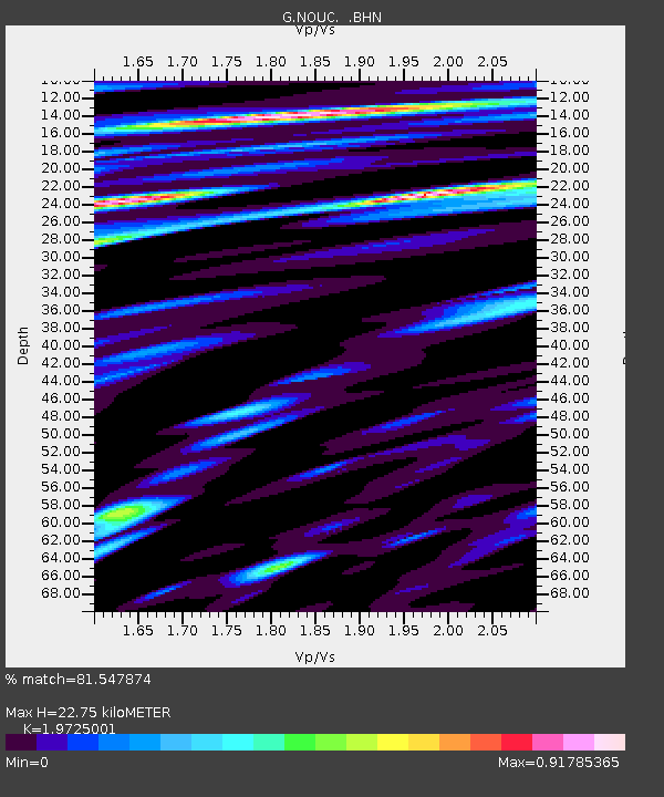
NOUC Port Laguerre, New Caledonia - Earthquake Result Viewer

Earthquake location: Southeast Of Honshu, Japan
Earthquake latitude/longitude: 32.0/137.9
Earthquake time(UTC): 1993/10/11 (284) 15:54:22 GMT
Earthquake Depth: 365 km
Earthquake Magnitude: 6.5 MB, 6.8 UNKNOWN, 6.9 MW
Earthquake Catalog/Contributor: WHDF/NEIC
Network: G GEOSCOPE
Station: NOUC Port Laguerre, New Caledonia
Lat/Lon: 22.10 S/166.30 E
Elevation: 112 m
Distance: 60.3 deg
Az: 149.426 deg
Baz: 332.226 deg
Ray Param: 0.060344726
Estimated Moho Depth: 22.75 km
Estimated Crust Vp/Vs: 1.97
Assumed Crust Vp: 5.14 km/s
Estimated Crust Vs: 2.606 km/s
Estimated Crust Poisson's Ratio: 0.33
Radial Match: 81.547874 %
Radial Bump: 400
Transverse Match: 75.8349 %
Transverse Bump: 400
SOD ConfigId: 16938
Insert Time: 2010-02-26 23:36:07.801 +0000
GWidth: 2.5
Max Bumps: 400
Tol: 0.001

Signal To Noise

ChannelStoNSTALTA
G:NOUC: :BHN:19931011T16:03:22.998999Z0.97340992.4322318E-72.4986716E-7
G:NOUC: :BHE:19931011T16:03:22.998999Z2.45049174.5260006E-71.8469765E-7
G:NOUC: :BHZ:19931011T16:03:22.998999Z2.84347271.1360397E-63.9952542E-7
Arrivals
Ps4.4 SECOND
PpPs13 SECOND
PsPs/PpSs17 SECOND