You are here: Home > Network List > TA - USArray Transportable Network (new EarthScope stations) Stations List
> Station 655A Horseshoe Beach, FL, USA > Earthquake Result Viewer
655A Horseshoe Beach, FL, USA - Earthquake Result Viewer

| Earthquake location: |
Peru-Bolivia Border Region |
| Earthquake latitude/longitude: |
-17.7/-69.6 |
| Earthquake time(UTC): |
2012/05/14 (135) 10:00:40 GMT |
| Earthquake Depth: |
106 km |
| Earthquake Magnitude: |
6.4 MB, 6.2 MW, 6.2 MW |
| Earthquake Catalog/Contributor: |
WHDF/NEIC |
|
| Network: |
TA USArray Transportable Network (new EarthScope stations) |
| Station: |
655A Horseshoe Beach, FL, USA |
| Lat/Lon: |
29.51 N/83.26 W |
| Elevation: |
6.0 m |
|
| Distance: |
48.7 deg |
| Az: |
344.1 deg |
| Baz: |
162.564 deg |
| Ray Param: |
0.06880435 |
| Estimated Moho Depth: |
14.75 km |
| Estimated Crust Vp/Vs: |
1.60 |
| Assumed Crust Vp: |
5.989 km/s |
| Estimated Crust Vs: |
3.743 km/s |
| Estimated Crust Poisson's Ratio: |
0.18 |
|
| Radial Match: |
94.774956 % |
| Radial Bump: |
281 |
| Transverse Match: |
82.06167 % |
| Transverse Bump: |
400 |
| SOD ConfigId: |
446234 |
| Insert Time: |
2012-08-08 22:47:46.653 +0000 |
| GWidth: |
2.5 |
| Max Bumps: |
400 |
| Tol: |
0.001 |
|
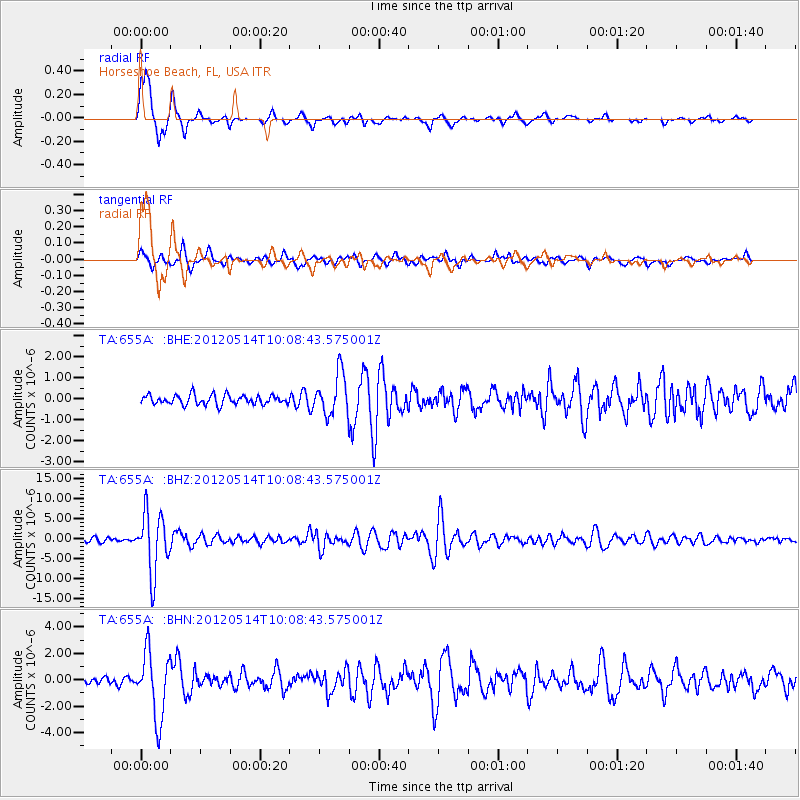
Signal To Noise
| Channel | StoN | STA | LTA |
| TA:655A: :BHZ:20120514T10:08:43.575001Z | 16.530231 | 7.48359E-6 | 4.5272142E-7 |
| TA:655A: :BHN:20120514T10:08:43.575001Z | 10.542785 | 2.4808608E-6 | 2.353136E-7 |
| TA:655A: :BHE:20120514T10:08:43.575001Z | 4.323922 | 9.803348E-7 | 2.2672351E-7 |
| Arrivals |
| Ps | 1.6 SECOND |
| PpPs | 6.1 SECOND |
| PsPs/PpSs | 7.6 SECOND |


