NOUC Port Laguerre, New Caledonia - Earthquake Result Viewer
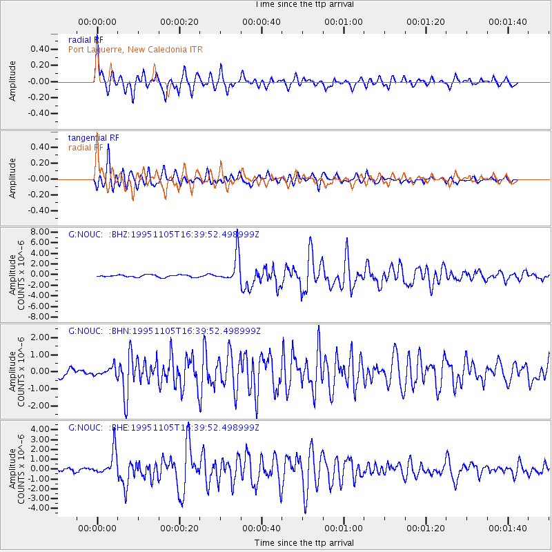
Earthquake location: Southern Sumatra, Indonesia
Earthquake latitude/longitude: -4.9/103.2
Earthquake time(UTC): 1995/11/05 (309) 16:30:00 GMT
Earthquake Depth: 58 km
Earthquake Magnitude: 6.3 MB, 6.1 MS, 5.9 UNKNOWN, 6.3 MW
Earthquake Catalog/Contributor: WHDF/NEIC
Network: G GEOSCOPE
Station: NOUC Port Laguerre, New Caledonia
Lat/Lon: 22.10 S/166.30 E
Elevation: 112 m
Distance: 63.2 deg
Az: 112.164 deg
Baz: 275.756 deg
Ray Param: 0.059578378
Estimated Moho Depth: 51.25 km
Estimated Crust Vp/Vs: 2.10
Assumed Crust Vp: 5.14 km/s
Estimated Crust Vs: 2.453 km/s
Estimated Crust Poisson's Ratio: 0.35
Radial Match: 92.075325 %
Radial Bump: 400
Transverse Match: 90.74907 %
Transverse Bump: 400
SOD ConfigId: 6273
Insert Time: 2010-02-26 23:36:37.604 +0000
GWidth: 2.5
Max Bumps: 400
Tol: 0.001

Signal To Noise

ChannelStoNSTALTA
G:NOUC: :BHN:19951105T16:39:52.498999Z1.26983182.616309E-72.0603586E-7
G:NOUC: :BHE:19951105T16:39:52.498999Z10.0018071.3498006E-61.3495567E-7
G:NOUC: :BHZ:19951105T16:39:52.498999Z13.0517182.7968103E-62.1428676E-7
Arrivals
Ps11 SECOND
PpPs30 SECOND
PsPs/PpSs41 SECOND