You are here: Home > Network List > UW - Pacific Northwest Regional Seismic Network Stations List
> Station LEBA Lebam, WA, USA > Earthquake Result Viewer
LEBA Lebam, WA, USA - Earthquake Result Viewer
*The percent match for this event was below the threshold and hence no stack was calculated.
| Earthquake location: |
Solomon Islands |
| Earthquake latitude/longitude: |
-6.6/155.0 |
| Earthquake time(UTC): |
2014/05/11 (131) 15:32:22 GMT |
| Earthquake Depth: |
50 km |
| Earthquake Magnitude: |
5.2 MW |
| Earthquake Catalog/Contributor: |
ISC/ISC |
|
| Network: |
UW Pacific Northwest Regional Seismic Network |
| Station: |
LEBA Lebam, WA, USA |
| Lat/Lon: |
46.55 N/123.56 W |
| Elevation: |
73 m |
|
| Distance: |
88.8 deg |
| Az: |
43.045 deg |
| Baz: |
259.277 deg |
| Ray Param: |
$rayparam |
*The percent match for this event was below the threshold and hence was not used in the summary stack. |
|
| Radial Match: |
58.76497 % |
| Radial Bump: |
400 |
| Transverse Match: |
53.74369 % |
| Transverse Bump: |
400 |
| SOD ConfigId: |
3390531 |
| Insert Time: |
2019-04-11 19:55:54.192 +0000 |
| GWidth: |
2.5 |
| Max Bumps: |
400 |
| Tol: |
0.001 |
|
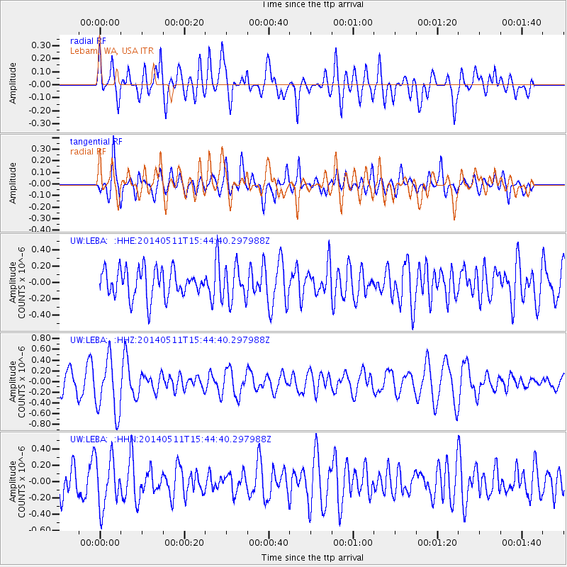
Signal To Noise
| Channel | StoN | STA | LTA |
| UW:LEBA: :HHZ:20140511T15:44:40.297988Z | 2.4542258 | 5.281105E-7 | 2.1518414E-7 |
| UW:LEBA: :HHN:20140511T15:44:40.297988Z | 1.9008123 | 2.9411405E-7 | 1.5473071E-7 |
| UW:LEBA: :HHE:20140511T15:44:40.297988Z | 1.2029445 | 2.0600574E-7 | 1.7125123E-7 |
| Arrivals |
| Ps | |
| PpPs | |
| PsPs/PpSs | |


