NOUC Port Laguerre, New Caledonia - Earthquake Result Viewer
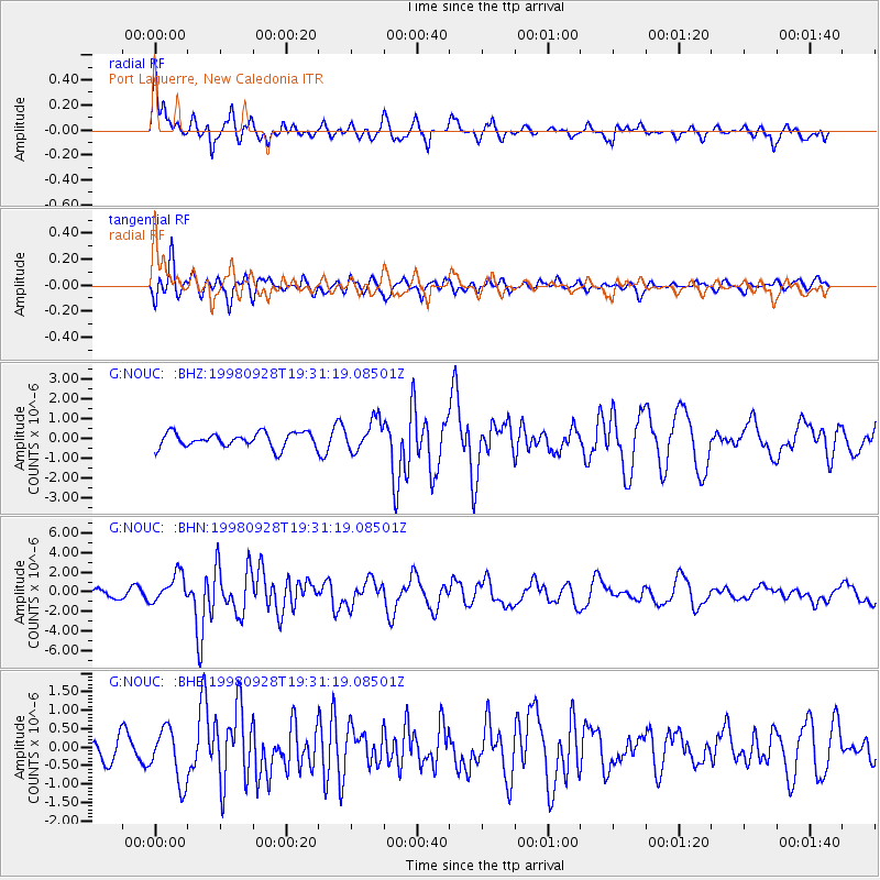
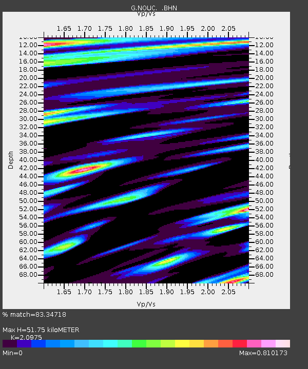
Earthquake location: Talaud Islands, Indonesia
Earthquake latitude/longitude: 3.8/126.4
Earthquake time(UTC): 1998/09/28 (271) 19:23:23 GMT
Earthquake Depth: 30 km
Earthquake Magnitude: 5.8 MB, 5.9 MS, 6.2 UNKNOWN, 6.1 MW
Earthquake Catalog/Contributor: WHDF/NEIC
Network: G GEOSCOPE
Station: NOUC Port Laguerre, New Caledonia
Lat/Lon: 22.10 S/166.30 E
Elevation: 112 m
Distance: 46.8 deg
Az: 125.263 deg
Baz: 298.54 deg
Ray Param: 0.07038306
Estimated Moho Depth: 51.75 km
Estimated Crust Vp/Vs: 2.10
Assumed Crust Vp: 5.14 km/s
Estimated Crust Vs: 2.451 km/s
Estimated Crust Poisson's Ratio: 0.35
Radial Match: 83.34718 %
Radial Bump: 398
Transverse Match: 77.14768 %
Transverse Bump: 400
SOD ConfigId: 4480
Insert Time: 2010-02-26 23:36:57.555 +0000
GWidth: 2.5
Max Bumps: 400
Tol: 0.001

Signal To Noise

ChannelStoNSTALTA
G:NOUC: :BHN:19980928T19:31:19.08501Z5.24152661.4606762E-62.7867384E-7
G:NOUC: :BHE:19980928T19:31:19.08501Z1.5707267.3377987E-74.6715965E-7
G:NOUC: :BHZ:19980928T19:31:19.08501Z2.08914187.712007E-73.6914713E-7
Arrivals
Ps11 SECOND
PpPs30 SECOND
PsPs/PpSs42 SECOND