You are here: Home > Network List > TA - USArray Transportable Network (new EarthScope stations) Stations List
> Station L04D Klamath Falls, OR, USA > Earthquake Result Viewer
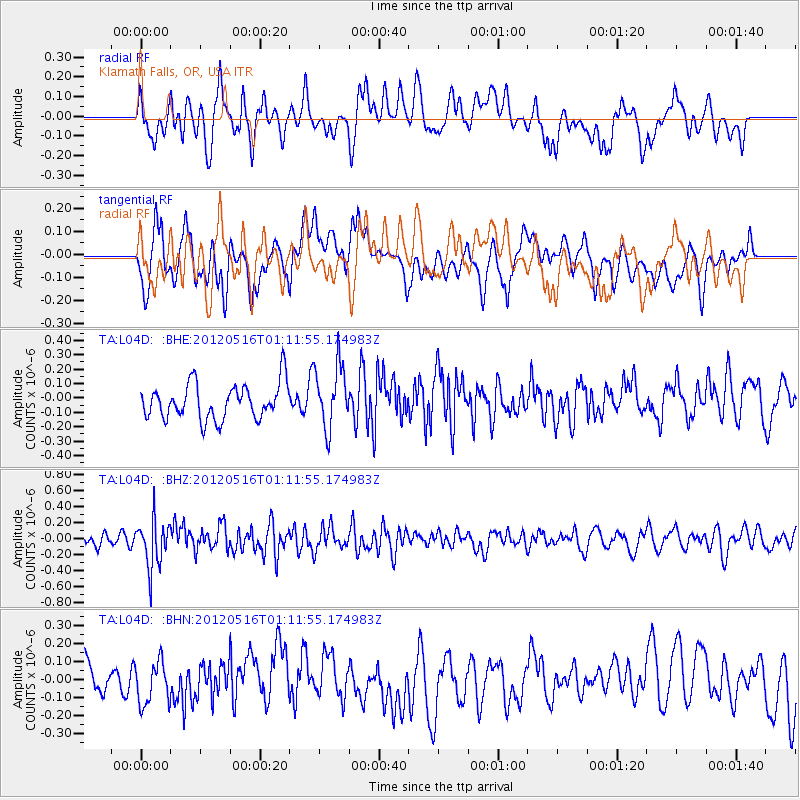
L04D Klamath Falls, OR, USA - Earthquake Result Viewer
*The percent match for this event was below the threshold and hence no stack was calculated.
| Earthquake location: |
New Britain Region, P.N.G. |
| Earthquake latitude/longitude: |
-5.5/149.7 |
| Earthquake time(UTC): |
2012/05/16 (137) 00:59:32 GMT |
| Earthquake Depth: |
137 km |
| Earthquake Magnitude: |
5.7 MB, 5.7 MW, 5.8 MW |
| Earthquake Catalog/Contributor: |
WHDF/NEIC |
|
| Network: |
TA USArray Transportable Network (new EarthScope stations) |
| Station: |
L04D Klamath Falls, OR, USA |
| Lat/Lon: |
42.22 N/122.30 W |
| Elevation: |
1437 m |
|
| Distance: |
92.2 deg |
| Az: |
47.98 deg |
| Baz: |
264.59 deg |
| Ray Param: |
$rayparam |
*The percent match for this event was below the threshold and hence was not used in the summary stack. |
|
| Radial Match: |
49.56421 % |
| Radial Bump: |
400 |
| Transverse Match: |
46.258537 % |
| Transverse Bump: |
400 |
| SOD ConfigId: |
446234 |
| Insert Time: |
2012-08-08 23:19:57.165 +0000 |
| GWidth: |
2.5 |
| Max Bumps: |
400 |
| Tol: |
0.001 |
|
Signal To Noise
| Channel | StoN | STA | LTA |
| TA:L04D: :BHZ:20120516T01:11:55.174983Z | 3.4236376 | 3.0111954E-7 | 8.79531E-8 |
| TA:L04D: :BHN:20120516T01:11:55.174983Z | 1.0131211 | 1.1576776E-7 | 1.1426843E-7 |
| TA:L04D: :BHE:20120516T01:11:55.174983Z | 1.7822622 | 2.1769822E-7 | 1.2214713E-7 |
| Arrivals |
| Ps | |
| PpPs | |
| PsPs/PpSs | |


