You are here: Home > Network List > TA - USArray Transportable Network (new EarthScope stations) Stations List
> Station O03D Paynes Creek, CA, USA > Earthquake Result Viewer
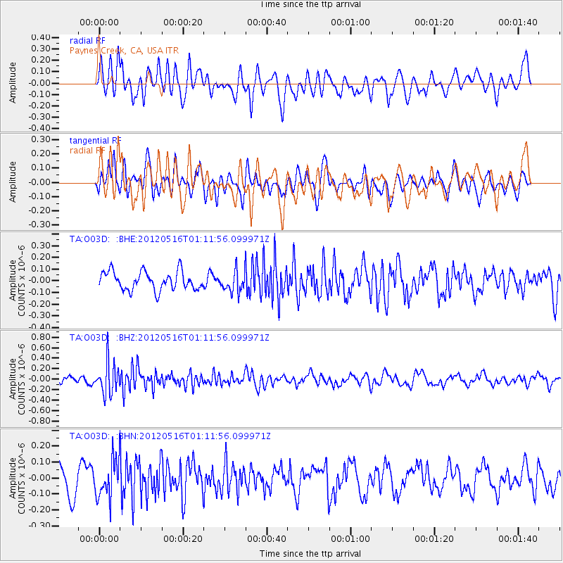
O03D Paynes Creek, CA, USA - Earthquake Result Viewer
*The percent match for this event was below the threshold and hence no stack was calculated.
| Earthquake location: |
New Britain Region, P.N.G. |
| Earthquake latitude/longitude: |
-5.5/149.7 |
| Earthquake time(UTC): |
2012/05/16 (137) 00:59:32 GMT |
| Earthquake Depth: |
137 km |
| Earthquake Magnitude: |
5.7 MB, 5.7 MW, 5.8 MW |
| Earthquake Catalog/Contributor: |
WHDF/NEIC |
|
| Network: |
TA USArray Transportable Network (new EarthScope stations) |
| Station: |
O03D Paynes Creek, CA, USA |
| Lat/Lon: |
40.29 N/121.80 W |
| Elevation: |
968 m |
|
| Distance: |
92.4 deg |
| Az: |
49.929 deg |
| Baz: |
264.843 deg |
| Ray Param: |
$rayparam |
*The percent match for this event was below the threshold and hence was not used in the summary stack. |
|
| Radial Match: |
63.204094 % |
| Radial Bump: |
400 |
| Transverse Match: |
56.64902 % |
| Transverse Bump: |
400 |
| SOD ConfigId: |
446234 |
| Insert Time: |
2012-08-08 23:20:12.337 +0000 |
| GWidth: |
2.5 |
| Max Bumps: |
400 |
| Tol: |
0.001 |
|
Signal To Noise
| Channel | StoN | STA | LTA |
| TA:O03D: :BHZ:20120516T01:11:56.099971Z | 5.244309 | 3.0525538E-7 | 5.8206982E-8 |
| TA:O03D: :BHN:20120516T01:11:56.099971Z | 1.6738924 | 1.2138882E-7 | 7.2518894E-8 |
| TA:O03D: :BHE:20120516T01:11:56.099971Z | 1.1940274 | 9.394991E-8 | 7.868321E-8 |
| Arrivals |
| Ps | |
| PpPs | |
| PsPs/PpSs | |


