You are here: Home > Network List > G - GEOSCOPE Stations List
> Station NOUC Port Laguerre, New Caledonia > Earthquake Result Viewer
NOUC Port Laguerre, New Caledonia - Earthquake Result Viewer
*The percent match for this event was below the threshold and hence no stack was calculated.
| Earthquake location: |
Southeast Of Honshu, Japan |
| Earthquake latitude/longitude: |
29.2/140.4 |
| Earthquake time(UTC): |
1996/02/14 (045) 21:26:56 GMT |
| Earthquake Depth: |
142 km |
| Earthquake Magnitude: |
5.9 MB |
| Earthquake Catalog/Contributor: |
WHDF/NEIC |
|
| Network: |
G GEOSCOPE |
| Station: |
NOUC Port Laguerre, New Caledonia |
| Lat/Lon: |
22.10 S/166.30 E |
| Elevation: |
112 m |
|
| Distance: |
56.8 deg |
| Az: |
151.026 deg |
| Baz: |
332.832 deg |
| Ray Param: |
$rayparam |
*The percent match for this event was below the threshold and hence was not used in the summary stack. |
|
| Radial Match: |
62.46972 % |
| Radial Bump: |
400 |
| Transverse Match: |
68.7007 % |
| Transverse Bump: |
400 |
| SOD ConfigId: |
4480 |
| Insert Time: |
2010-02-26 23:37:06.276 +0000 |
| GWidth: |
2.5 |
| Max Bumps: |
400 |
| Tol: |
0.001 |
|
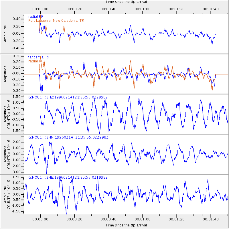
Signal To Noise
| Channel | StoN | STA | LTA |
| G:NOUC: :BHN:19960214T21:35:55.022998Z | 1.8964025 | 1.4772546E-6 | 7.789774E-7 |
| G:NOUC: :BHE:19960214T21:35:55.022998Z | 0.4333456 | 3.7057723E-7 | 8.5515404E-7 |
| G:NOUC: :BHZ:19960214T21:35:55.022998Z | 1.8109119 | 9.865838E-7 | 5.4479943E-7 |
| Arrivals |
| Ps | |
| PpPs | |
| PsPs/PpSs | |


