You are here: Home > Network List > TA - USArray Transportable Network (new EarthScope stations) Stations List
> Station G36A St. Michael, MN, USA > Earthquake Result Viewer
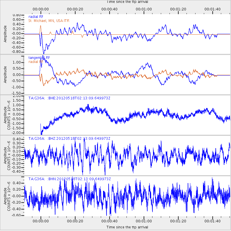
G36A St. Michael, MN, USA - Earthquake Result Viewer
*The percent match for this event was below the threshold and hence no stack was calculated.
| Earthquake location: |
Off Coast Of Southern Chile |
| Earthquake latitude/longitude: |
-44.8/-80.2 |
| Earthquake time(UTC): |
2012/05/18 (139) 02:00:39 GMT |
| Earthquake Depth: |
10 km |
| Earthquake Magnitude: |
5.5 MB, 5.7 MS, 6.3 MW, 6.3 MW |
| Earthquake Catalog/Contributor: |
WHDF/NEIC |
|
| Network: |
TA USArray Transportable Network (new EarthScope stations) |
| Station: |
G36A St. Michael, MN, USA |
| Lat/Lon: |
45.23 N/93.75 W |
| Elevation: |
293 m |
|
| Distance: |
90.5 deg |
| Az: |
350.441 deg |
| Baz: |
170.369 deg |
| Ray Param: |
$rayparam |
*The percent match for this event was below the threshold and hence was not used in the summary stack. |
|
| Radial Match: |
45.419918 % |
| Radial Bump: |
400 |
| Transverse Match: |
35.80643 % |
| Transverse Bump: |
400 |
| SOD ConfigId: |
446234 |
| Insert Time: |
2012-08-08 23:29:53.251 +0000 |
| GWidth: |
2.5 |
| Max Bumps: |
400 |
| Tol: |
0.001 |
|
Signal To Noise
| Channel | StoN | STA | LTA |
| TA:G36A: :BHZ:20120518T02:13:09.649973Z | 0.93751454 | 1.0354043E-7 | 1.1044141E-7 |
| TA:G36A: :BHN:20120518T02:13:09.649973Z | 1.1735423 | 2.7470674E-7 | 2.3408336E-7 |
| TA:G36A: :BHE:20120518T02:13:09.649973Z | 1.3381424 | 9.331684E-7 | 6.973611E-7 |
| Arrivals |
| Ps | |
| PpPs | |
| PsPs/PpSs | |


