You are here: Home > Network List > TA - USArray Transportable Network (new EarthScope stations) Stations List
> Station Z46A Louisville, MS, USA > Earthquake Result Viewer
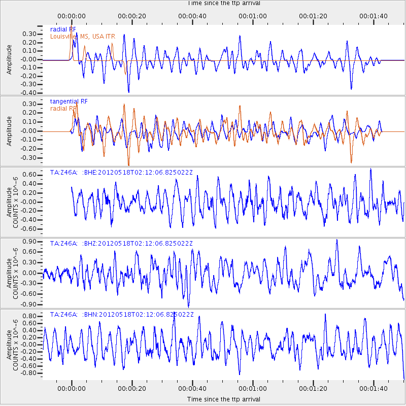
Z46A Louisville, MS, USA - Earthquake Result Viewer
*The percent match for this event was below the threshold and hence no stack was calculated.
| Earthquake location: |
Off Coast Of Southern Chile |
| Earthquake latitude/longitude: |
-44.8/-80.2 |
| Earthquake time(UTC): |
2012/05/18 (139) 02:00:39 GMT |
| Earthquake Depth: |
10 km |
| Earthquake Magnitude: |
5.5 MB, 5.7 MS, 6.3 MW, 6.3 MW |
| Earthquake Catalog/Contributor: |
WHDF/NEIC |
|
| Network: |
TA USArray Transportable Network (new EarthScope stations) |
| Station: |
Z46A Louisville, MS, USA |
| Lat/Lon: |
33.19 N/88.94 W |
| Elevation: |
125 m |
|
| Distance: |
78.0 deg |
| Az: |
352.48 deg |
| Baz: |
173.621 deg |
| Ray Param: |
$rayparam |
*The percent match for this event was below the threshold and hence was not used in the summary stack. |
|
| Radial Match: |
48.128075 % |
| Radial Bump: |
400 |
| Transverse Match: |
46.91936 % |
| Transverse Bump: |
400 |
| SOD ConfigId: |
446234 |
| Insert Time: |
2012-08-08 23:31:50.761 +0000 |
| GWidth: |
2.5 |
| Max Bumps: |
400 |
| Tol: |
0.001 |
|
Signal To Noise
| Channel | StoN | STA | LTA |
| TA:Z46A: :BHZ:20120518T02:12:06.825022Z | 1.8033501 | 2.4208606E-7 | 1.3424241E-7 |
| TA:Z46A: :BHN:20120518T02:12:06.825022Z | 0.7891682 | 2.3667687E-7 | 2.9990676E-7 |
| TA:Z46A: :BHE:20120518T02:12:06.825022Z | 1.4947982 | 2.8114803E-7 | 1.8808429E-7 |
| Arrivals |
| Ps | |
| PpPs | |
| PsPs/PpSs | |


