You are here: Home > Network List > TA - USArray Transportable Network (new EarthScope stations) Stations List
> Station G42A Mountain, WI, USA > Earthquake Result Viewer
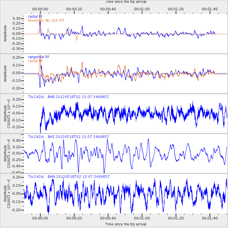
G42A Mountain, WI, USA - Earthquake Result Viewer
*The percent match for this event was below the threshold and hence no stack was calculated.
| Earthquake location: |
Off Coast Of Southern Chile |
| Earthquake latitude/longitude: |
-44.8/-80.2 |
| Earthquake time(UTC): |
2012/05/18 (139) 02:00:39 GMT |
| Earthquake Depth: |
10 km |
| Earthquake Magnitude: |
5.5 MB, 5.7 MS, 6.3 MW, 6.3 MW |
| Earthquake Catalog/Contributor: |
WHDF/NEIC |
|
| Network: |
TA USArray Transportable Network (new EarthScope stations) |
| Station: |
G42A Mountain, WI, USA |
| Lat/Lon: |
45.24 N/88.43 W |
| Elevation: |
315 m |
|
| Distance: |
90.0 deg |
| Az: |
354.168 deg |
| Baz: |
174.124 deg |
| Ray Param: |
$rayparam |
*The percent match for this event was below the threshold and hence was not used in the summary stack. |
|
| Radial Match: |
67.34856 % |
| Radial Bump: |
400 |
| Transverse Match: |
45.33193 % |
| Transverse Bump: |
400 |
| SOD ConfigId: |
446234 |
| Insert Time: |
2012-08-08 23:34:44.375 +0000 |
| GWidth: |
2.5 |
| Max Bumps: |
400 |
| Tol: |
0.001 |
|
Signal To Noise
| Channel | StoN | STA | LTA |
| TA:G42A: :BHZ:20120518T02:13:07.349985Z | 2.8831606 | 2.000483E-7 | 6.9385074E-8 |
| TA:G42A: :BHN:20120518T02:13:07.349985Z | 1.2420366 | 8.26728E-8 | 6.6562286E-8 |
| TA:G42A: :BHE:20120518T02:13:07.349985Z | 0.75466233 | 6.079602E-8 | 8.056056E-8 |
| Arrivals |
| Ps | |
| PpPs | |
| PsPs/PpSs | |


