You are here: Home > Network List > TA - USArray Transportable Network (new EarthScope stations) Stations List
> Station 151A Opelika, AL, USA > Earthquake Result Viewer
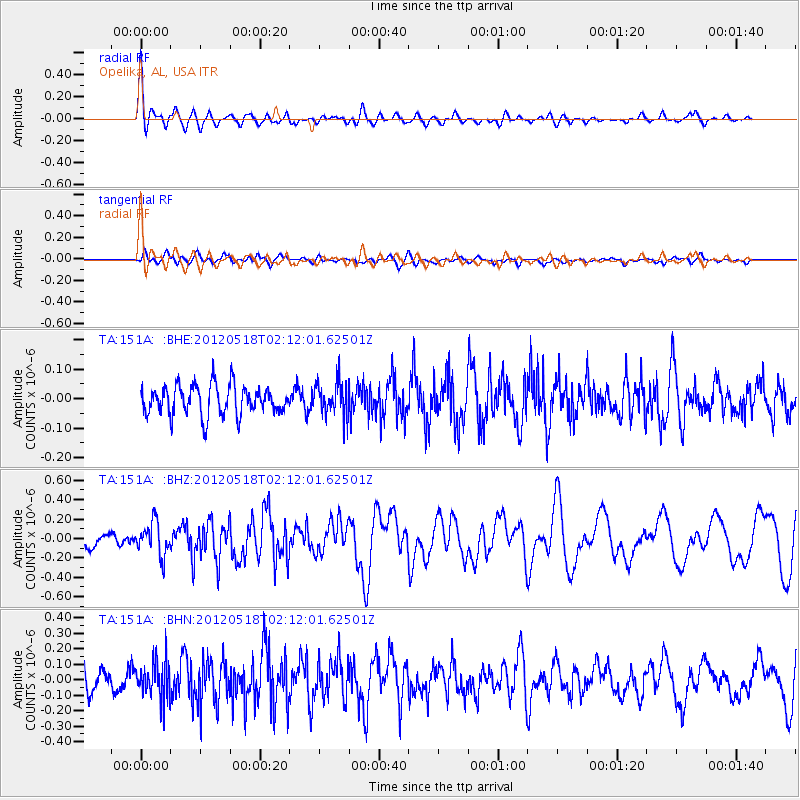
151A Opelika, AL, USA - Earthquake Result Viewer
*The percent match for this event was below the threshold and hence no stack was calculated.
| Earthquake location: |
Off Coast Of Southern Chile |
| Earthquake latitude/longitude: |
-44.8/-80.2 |
| Earthquake time(UTC): |
2012/05/18 (139) 02:00:39 GMT |
| Earthquake Depth: |
10 km |
| Earthquake Magnitude: |
5.5 MB, 5.7 MS, 6.3 MW, 6.3 MW |
| Earthquake Catalog/Contributor: |
WHDF/NEIC |
|
| Network: |
TA USArray Transportable Network (new EarthScope stations) |
| Station: |
151A Opelika, AL, USA |
| Lat/Lon: |
32.53 N/85.33 W |
| Elevation: |
211 m |
|
| Distance: |
77.1 deg |
| Az: |
355.523 deg |
| Baz: |
176.229 deg |
| Ray Param: |
$rayparam |
*The percent match for this event was below the threshold and hence was not used in the summary stack. |
|
| Radial Match: |
78.78414 % |
| Radial Bump: |
400 |
| Transverse Match: |
61.60494 % |
| Transverse Bump: |
400 |
| SOD ConfigId: |
446234 |
| Insert Time: |
2012-08-08 23:36:34.727 +0000 |
| GWidth: |
2.5 |
| Max Bumps: |
400 |
| Tol: |
0.001 |
|
Signal To Noise
| Channel | StoN | STA | LTA |
| TA:151A: :BHZ:20120518T02:12:01.62501Z | 2.6607168 | 1.6889896E-7 | 6.347875E-8 |
| TA:151A: :BHN:20120518T02:12:01.62501Z | 1.5059249 | 1.2027182E-7 | 7.986575E-8 |
| TA:151A: :BHE:20120518T02:12:01.62501Z | 1.1931859 | 5.891769E-8 | 4.937846E-8 |
| Arrivals |
| Ps | |
| PpPs | |
| PsPs/PpSs | |


