You are here: Home > Network List > G - GEOSCOPE Stations List
> Station NOUC Port Laguerre, New Caledonia > Earthquake Result Viewer
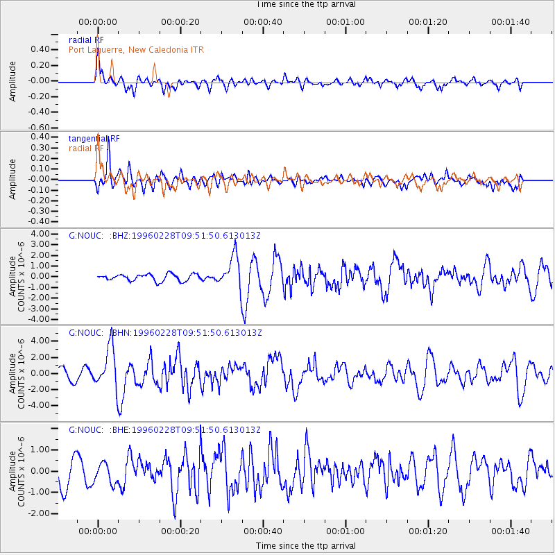
NOUC Port Laguerre, New Caledonia - Earthquake Result Viewer
*The percent match for this event was below the threshold and hence no stack was calculated.
| Earthquake location: |
Northern Molucca Sea |
| Earthquake latitude/longitude: |
1.7/126.1 |
| Earthquake time(UTC): |
1996/02/28 (059) 09:44:09 GMT |
| Earthquake Depth: |
103 km |
| Earthquake Magnitude: |
6.1 MB, 6.4 UNKNOWN, 6.4 MW |
| Earthquake Catalog/Contributor: |
WHDF/NEIC |
|
| Network: |
G GEOSCOPE |
| Station: |
NOUC Port Laguerre, New Caledonia |
| Lat/Lon: |
22.10 S/166.30 E |
| Elevation: |
112 m |
|
| Distance: |
45.8 deg |
| Az: |
123.429 deg |
| Baz: |
295.908 deg |
| Ray Param: |
$rayparam |
*The percent match for this event was below the threshold and hence was not used in the summary stack. |
|
| Radial Match: |
59.08099 % |
| Radial Bump: |
400 |
| Transverse Match: |
67.51619 % |
| Transverse Bump: |
400 |
| SOD ConfigId: |
4480 |
| Insert Time: |
2010-02-26 23:37:11.939 +0000 |
| GWidth: |
2.5 |
| Max Bumps: |
400 |
| Tol: |
0.001 |
|
Signal To Noise
| Channel | StoN | STA | LTA |
| G:NOUC: :BHN:19960228T09:51:50.613013Z | 5.102818 | 2.6705052E-6 | 5.2333934E-7 |
| G:NOUC: :BHE:19960228T09:51:50.613013Z | 0.6290035 | 4.7357332E-7 | 7.528945E-7 |
| G:NOUC: :BHZ:19960228T09:51:50.613013Z | 5.048993 | 1.5833507E-6 | 3.1359733E-7 |
| Arrivals |
| Ps | |
| PpPs | |
| PsPs/PpSs | |


