You are here: Home > Network List > G - GEOSCOPE Stations List
> Station NOUC Port Laguerre, New Caledonia > Earthquake Result Viewer
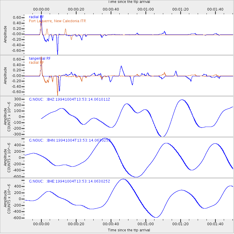
NOUC Port Laguerre, New Caledonia - Earthquake Result Viewer
*The percent match for this event was below the threshold and hence no stack was calculated.
| Earthquake location: |
Kuril Islands |
| Earthquake latitude/longitude: |
43.9/147.2 |
| Earthquake time(UTC): |
1994/10/04 (277) 13:42:49 GMT |
| Earthquake Depth: |
33 km |
| Earthquake Magnitude: |
6.1 MB |
| Earthquake Catalog/Contributor: |
WHDF/NEIC |
|
| Network: |
G GEOSCOPE |
| Station: |
NOUC Port Laguerre, New Caledonia |
| Lat/Lon: |
22.10 S/166.30 E |
| Elevation: |
112 m |
|
| Distance: |
67.9 deg |
| Az: |
160.918 deg |
| Baz: |
345.23 deg |
| Ray Param: |
$rayparam |
*The percent match for this event was below the threshold and hence was not used in the summary stack. |
|
| Radial Match: |
91.42047 % |
| Radial Bump: |
305 |
| Transverse Match: |
66.203575 % |
| Transverse Bump: |
400 |
| SOD ConfigId: |
4480 |
| Insert Time: |
2010-02-26 23:37:16.887 +0000 |
| GWidth: |
2.5 |
| Max Bumps: |
400 |
| Tol: |
0.001 |
|
Signal To Noise
| Channel | StoN | STA | LTA |
| G:NOUC: :BHN:19941004T13:53:14.063025Z | 0.8987189 | 6.5541884E-5 | 7.2928124E-5 |
| G:NOUC: :BHE:19941004T13:53:14.063025Z | 12.367267 | 2.1326824E-4 | 1.7244573E-5 |
| G:NOUC: :BHZ:19941004T13:53:14.061011Z | 1.0641655 | 8.413246E-5 | 7.9059566E-5 |
| Arrivals |
| Ps | |
| PpPs | |
| PsPs/PpSs | |


