You are here: Home > Network List > G - GEOSCOPE Stations List
> Station NOUC Port Laguerre, New Caledonia > Earthquake Result Viewer
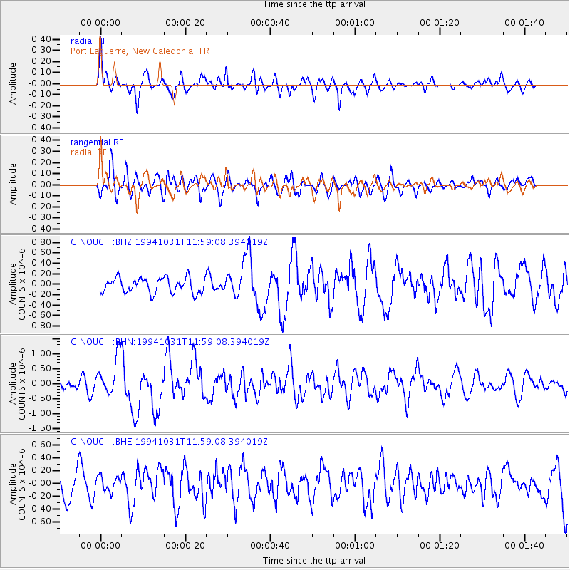
NOUC Port Laguerre, New Caledonia - Earthquake Result Viewer
*The percent match for this event was below the threshold and hence no stack was calculated.
| Earthquake location: |
Northern Sumatra, Indonesia |
| Earthquake latitude/longitude: |
3.0/96.3 |
| Earthquake time(UTC): |
1994/10/31 (304) 11:48:15 GMT |
| Earthquake Depth: |
46 km |
| Earthquake Magnitude: |
5.6 MB, 6.1 MS, 6.3 UNKNOWN, 6.2 MW |
| Earthquake Catalog/Contributor: |
WHDF/NEIC |
|
| Network: |
G GEOSCOPE |
| Station: |
NOUC Port Laguerre, New Caledonia |
| Lat/Lon: |
22.10 S/166.30 E |
| Elevation: |
112 m |
|
| Distance: |
72.7 deg |
| Az: |
114.116 deg |
| Baz: |
280.637 deg |
| Ray Param: |
$rayparam |
*The percent match for this event was below the threshold and hence was not used in the summary stack. |
|
| Radial Match: |
73.43511 % |
| Radial Bump: |
400 |
| Transverse Match: |
60.416748 % |
| Transverse Bump: |
400 |
| SOD ConfigId: |
4480 |
| Insert Time: |
2010-02-26 23:37:31.863 +0000 |
| GWidth: |
2.5 |
| Max Bumps: |
400 |
| Tol: |
0.001 |
|
Signal To Noise
| Channel | StoN | STA | LTA |
| G:NOUC: :BHN:19941031T11:59:08.394019Z | 5.189554 | 6.8035246E-7 | 1.3110036E-7 |
| G:NOUC: :BHE:19941031T11:59:08.394019Z | 0.43280664 | 1.1854506E-7 | 2.7389845E-7 |
| G:NOUC: :BHZ:19941031T11:59:08.394019Z | 2.3725889 | 3.3612406E-7 | 1.4166974E-7 |
| Arrivals |
| Ps | |
| PpPs | |
| PsPs/PpSs | |


