You are here: Home > Network List > G - GEOSCOPE Stations List
> Station NOUC Port Laguerre, New Caledonia > Earthquake Result Viewer
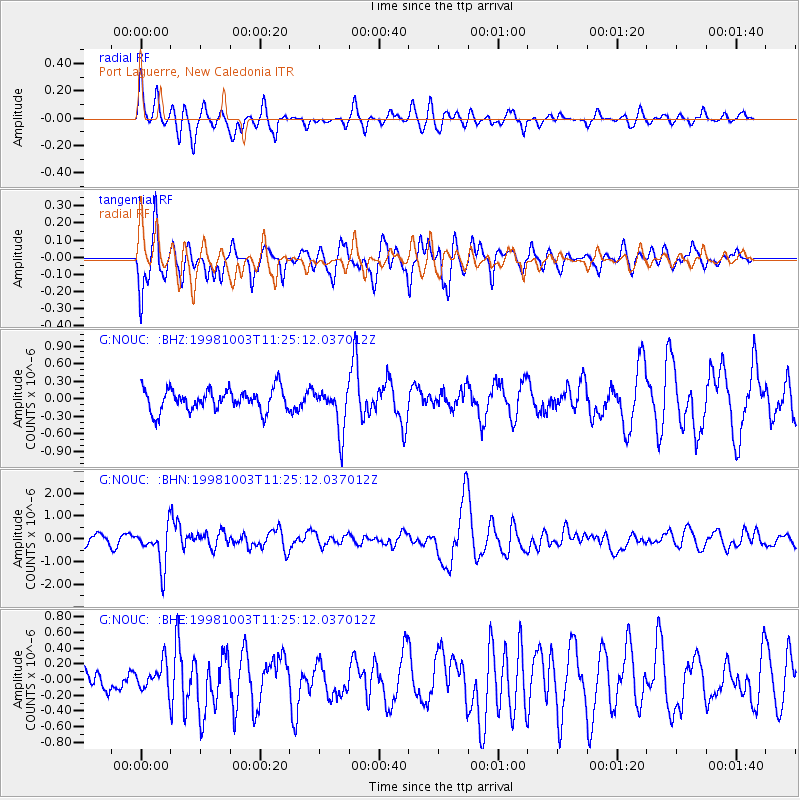
NOUC Port Laguerre, New Caledonia - Earthquake Result Viewer
*The percent match for this event was below the threshold and hence no stack was calculated.
| Earthquake location: |
Northwest Of Ryukyu Islands |
| Earthquake latitude/longitude: |
28.5/127.6 |
| Earthquake time(UTC): |
1998/10/03 (276) 11:15:42 GMT |
| Earthquake Depth: |
227 km |
| Earthquake Magnitude: |
5.6 MB, 6.1 UNKNOWN, 6.1 MW |
| Earthquake Catalog/Contributor: |
WHDF/NEIC |
|
| Network: |
G GEOSCOPE |
| Station: |
NOUC Port Laguerre, New Caledonia |
| Lat/Lon: |
22.10 S/166.30 E |
| Elevation: |
112 m |
|
| Distance: |
62.6 deg |
| Az: |
139.256 deg |
| Baz: |
321.727 deg |
| Ray Param: |
$rayparam |
*The percent match for this event was below the threshold and hence was not used in the summary stack. |
|
| Radial Match: |
70.21398 % |
| Radial Bump: |
400 |
| Transverse Match: |
72.540825 % |
| Transverse Bump: |
400 |
| SOD ConfigId: |
4480 |
| Insert Time: |
2010-02-26 23:37:33.714 +0000 |
| GWidth: |
2.5 |
| Max Bumps: |
400 |
| Tol: |
0.001 |
|
Signal To Noise
| Channel | StoN | STA | LTA |
| G:NOUC: :BHN:19981003T11:25:12.037012Z | 4.8948245 | 8.7223464E-7 | 1.781953E-7 |
| G:NOUC: :BHE:19981003T11:25:12.037012Z | 0.82773936 | 1.7629765E-7 | 2.129869E-7 |
| G:NOUC: :BHZ:19981003T11:25:12.037012Z | 1.9735572 | 3.7321342E-7 | 1.8910697E-7 |
| Arrivals |
| Ps | |
| PpPs | |
| PsPs/PpSs | |


