You are here: Home > Network List > GS - US Geological Survey Networks Stations List
> Station DEC12 Boyd Road Surface Site > Earthquake Result Viewer
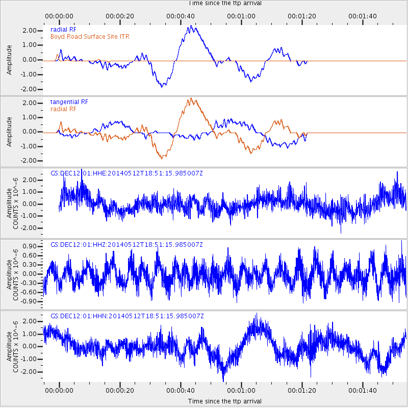
DEC12 Boyd Road Surface Site - Earthquake Result Viewer
*The percent match for this event was below the threshold and hence no stack was calculated.
| Earthquake location: |
Southern East Pacific Rise |
| Earthquake latitude/longitude: |
-50.0/-114.7 |
| Earthquake time(UTC): |
2014/05/12 (132) 18:38:37 GMT |
| Earthquake Depth: |
8.2 km |
| Earthquake Magnitude: |
5.8 MB |
| Earthquake Catalog/Contributor: |
NEIC PDE/NEIC COMCAT |
|
| Network: |
GS US Geological Survey Networks |
| Station: |
DEC12 Boyd Road Surface Site |
| Lat/Lon: |
39.91 N/88.91 W |
| Elevation: |
208 m |
|
| Distance: |
92.3 deg |
| Az: |
19.549 deg |
| Baz: |
196.314 deg |
| Ray Param: |
$rayparam |
*The percent match for this event was below the threshold and hence was not used in the summary stack. |
|
| Radial Match: |
46.22412 % |
| Radial Bump: |
400 |
| Transverse Match: |
25.462275 % |
| Transverse Bump: |
400 |
| SOD ConfigId: |
3390531 |
| Insert Time: |
2019-04-11 20:10:58.455 +0000 |
| GWidth: |
2.5 |
| Max Bumps: |
400 |
| Tol: |
0.001 |
|
Signal To Noise
| Channel | StoN | STA | LTA |
| GS:DEC12:01:HHZ:20140512T18:51:15.985007Z | 1.0763469 | 2.7500803E-7 | 2.555013E-7 |
| GS:DEC12:01:HHN:20140512T18:51:15.985007Z | 1.5621738 | 1.5265682E-6 | 9.772076E-7 |
| GS:DEC12:01:HHE:20140512T18:51:15.985007Z | 0.64006925 | 4.713757E-7 | 7.3644486E-7 |
| Arrivals |
| Ps | |
| PpPs | |
| PsPs/PpSs | |


