You are here: Home > Network List > G - GEOSCOPE Stations List
> Station NOUC Port Laguerre, New Caledonia > Earthquake Result Viewer
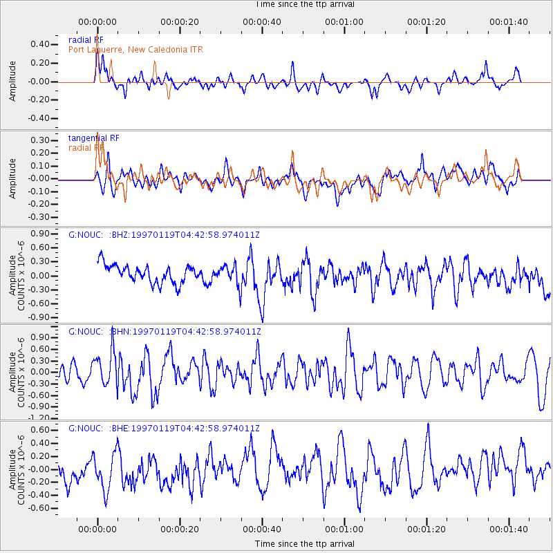
NOUC Port Laguerre, New Caledonia - Earthquake Result Viewer
*The percent match for this event was below the threshold and hence no stack was calculated.
| Earthquake location: |
Philippine Islands Region |
| Earthquake latitude/longitude: |
20.0/121.4 |
| Earthquake time(UTC): |
1997/01/19 (019) 04:33:22 GMT |
| Earthquake Depth: |
33 km |
| Earthquake Magnitude: |
5.7 MB, 5.4 MS, 5.9 UNKNOWN, 5.8 MW |
| Earthquake Catalog/Contributor: |
WHDF/NEIC |
|
| Network: |
G GEOSCOPE |
| Station: |
NOUC Port Laguerre, New Caledonia |
| Lat/Lon: |
22.10 S/166.30 E |
| Elevation: |
112 m |
|
| Distance: |
60.6 deg |
| Az: |
131.305 deg |
| Baz: |
310.372 deg |
| Ray Param: |
$rayparam |
*The percent match for this event was below the threshold and hence was not used in the summary stack. |
|
| Radial Match: |
64.0058 % |
| Radial Bump: |
400 |
| Transverse Match: |
38.491806 % |
| Transverse Bump: |
400 |
| SOD ConfigId: |
4480 |
| Insert Time: |
2010-02-26 23:37:36.394 +0000 |
| GWidth: |
2.5 |
| Max Bumps: |
400 |
| Tol: |
0.001 |
|
Signal To Noise
| Channel | StoN | STA | LTA |
| G:NOUC: :BHN:19970119T04:42:58.974011Z | 2.3575852 | 4.5996248E-7 | 1.9509898E-7 |
| G:NOUC: :BHE:19970119T04:42:58.974011Z | 1.2021908 | 3.237078E-7 | 2.6926494E-7 |
| G:NOUC: :BHZ:19970119T04:42:58.974011Z | 1.1329204 | 2.1987499E-7 | 1.9407807E-7 |
| Arrivals |
| Ps | |
| PpPs | |
| PsPs/PpSs | |


