You are here: Home > Network List > G - GEOSCOPE Stations List
> Station NOUC Port Laguerre, New Caledonia > Earthquake Result Viewer
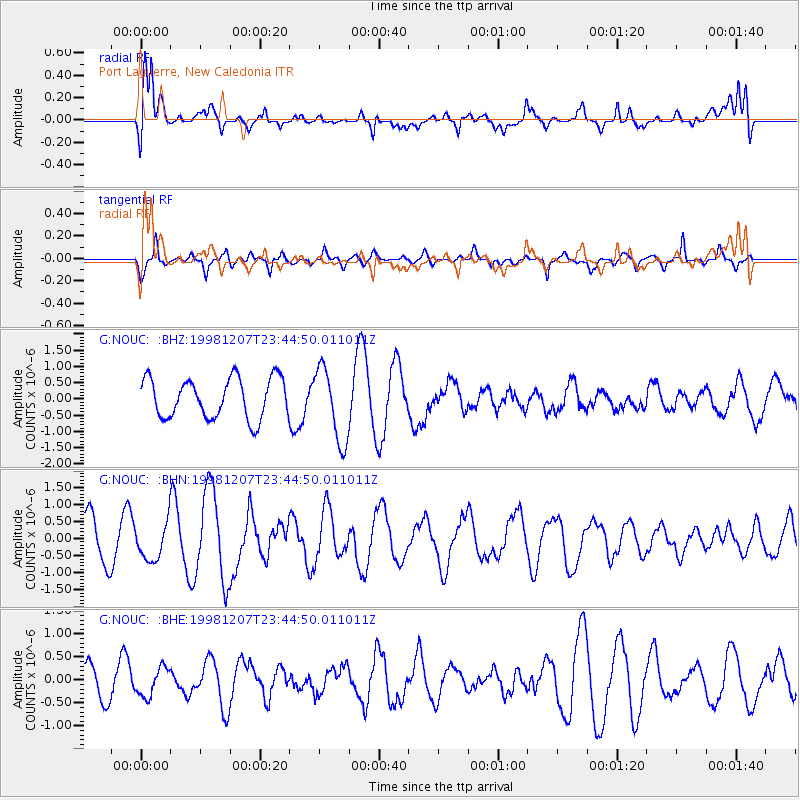
NOUC Port Laguerre, New Caledonia - Earthquake Result Viewer
*The percent match for this event was below the threshold and hence no stack was calculated.
| Earthquake location: |
Flores Region, Indonesia |
| Earthquake latitude/longitude: |
-8.3/121.4 |
| Earthquake time(UTC): |
1998/12/07 (341) 23:37:06 GMT |
| Earthquake Depth: |
33 km |
| Earthquake Magnitude: |
5.5 MB, 5.4 MS, 5.9 UNKNOWN, 5.8 MW |
| Earthquake Catalog/Contributor: |
WHDF/NEIC |
|
| Network: |
G GEOSCOPE |
| Station: |
NOUC Port Laguerre, New Caledonia |
| Lat/Lon: |
22.10 S/166.30 E |
| Elevation: |
112 m |
|
| Distance: |
45.2 deg |
| Az: |
112.832 deg |
| Baz: |
280.45 deg |
| Ray Param: |
$rayparam |
*The percent match for this event was below the threshold and hence was not used in the summary stack. |
|
| Radial Match: |
61.476986 % |
| Radial Bump: |
400 |
| Transverse Match: |
77.93369 % |
| Transverse Bump: |
396 |
| SOD ConfigId: |
4480 |
| Insert Time: |
2010-02-26 23:37:36.901 +0000 |
| GWidth: |
2.5 |
| Max Bumps: |
400 |
| Tol: |
0.001 |
|
Signal To Noise
| Channel | StoN | STA | LTA |
| G:NOUC: :BHN:19981207T23:44:50.011011Z | 0.98244727 | 5.423224E-7 | 5.520117E-7 |
| G:NOUC: :BHE:19981207T23:44:50.011011Z | 0.99220127 | 3.1172604E-7 | 3.1417622E-7 |
| G:NOUC: :BHZ:19981207T23:44:50.011011Z | 1.8651398 | 1.1459255E-6 | 6.143912E-7 |
| Arrivals |
| Ps | |
| PpPs | |
| PsPs/PpSs | |


