You are here: Home > Network List > G - GEOSCOPE Stations List
> Station NOUC Port Laguerre, New Caledonia > Earthquake Result Viewer
NOUC Port Laguerre, New Caledonia - Earthquake Result Viewer
*The percent match for this event was below the threshold and hence no stack was calculated.
| Earthquake location: |
Samar, Philippines |
| Earthquake latitude/longitude: |
11.9/125.6 |
| Earthquake time(UTC): |
1995/04/21 (111) 00:30:12 GMT |
| Earthquake Depth: |
33 km |
| Earthquake Magnitude: |
6.3 MB, 7.0 MS, 7.2 UNKNOWN |
| Earthquake Catalog/Contributor: |
WHDF/NEIC |
|
| Network: |
G GEOSCOPE |
| Station: |
NOUC Port Laguerre, New Caledonia |
| Lat/Lon: |
22.10 S/166.30 E |
| Elevation: |
112 m |
|
| Distance: |
52.3 deg |
| Az: |
130.129 deg |
| Baz: |
306.2 deg |
| Ray Param: |
$rayparam |
*The percent match for this event was below the threshold and hence was not used in the summary stack. |
|
| Radial Match: |
75.524124 % |
| Radial Bump: |
400 |
| Transverse Match: |
74.75503 % |
| Transverse Bump: |
256 |
| SOD ConfigId: |
4480 |
| Insert Time: |
2010-02-26 23:37:46.109 +0000 |
| GWidth: |
2.5 |
| Max Bumps: |
400 |
| Tol: |
0.001 |
|
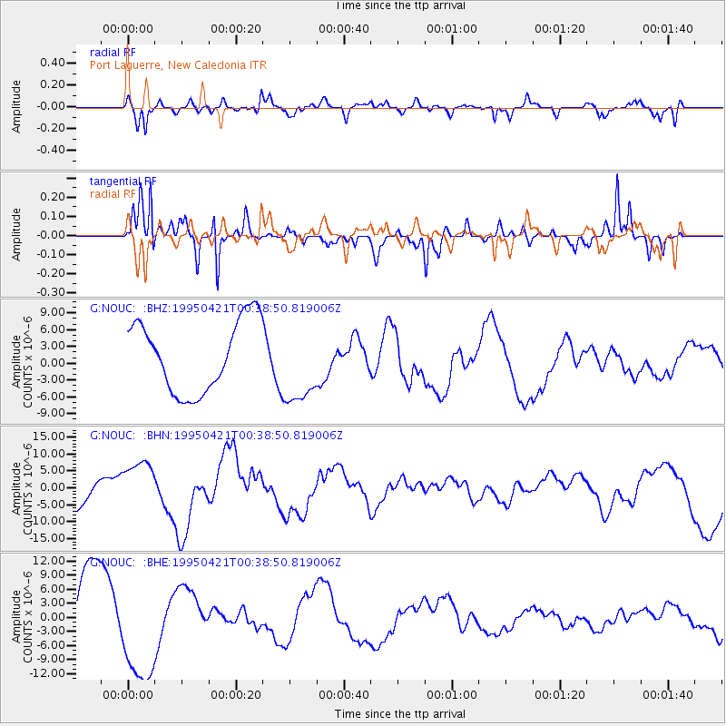
Signal To Noise
| Channel | StoN | STA | LTA |
| G:NOUC: :BHN:19950421T00:38:50.819006Z | 1.414355 | 7.338033E-6 | 5.1882535E-6 |
| G:NOUC: :BHE:19950421T00:38:50.819006Z | 1.8650686 | 1.2017895E-5 | 6.443675E-6 |
| G:NOUC: :BHZ:19950421T00:38:50.819006Z | 1.1297659 | 7.172654E-6 | 6.3487964E-6 |
| Arrivals |
| Ps | |
| PpPs | |
| PsPs/PpSs | |


