You are here: Home > Network List > TA - USArray Transportable Network (new EarthScope stations) Stations List
> Station T44A Benton, MO, USA > Earthquake Result Viewer
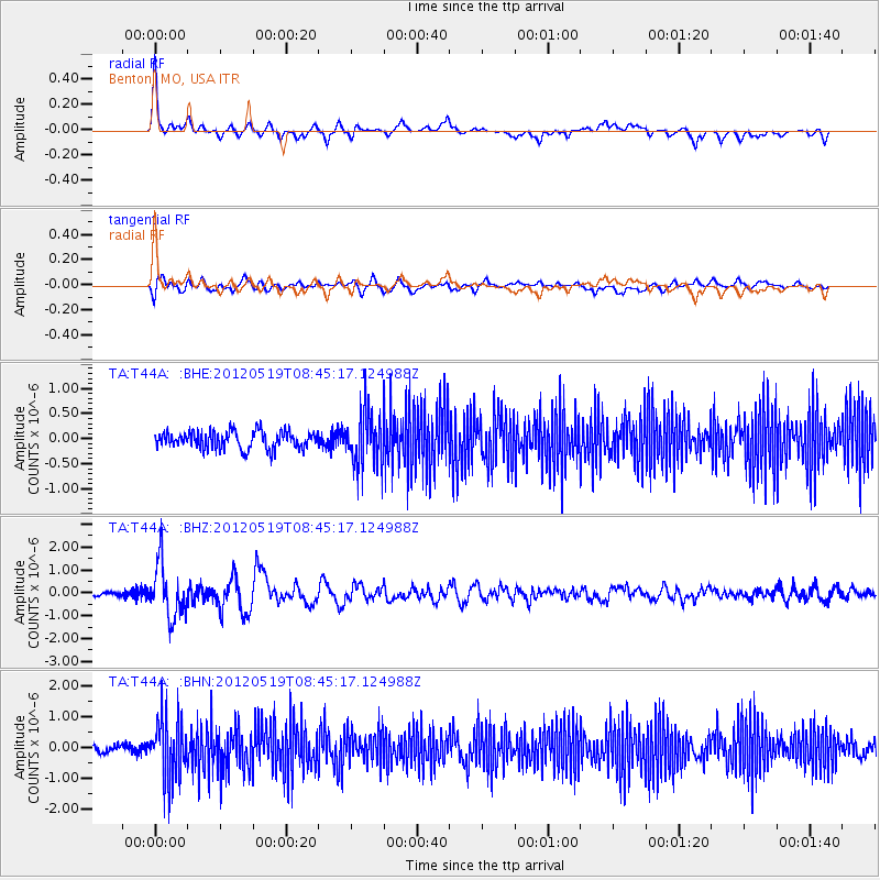
T44A Benton, MO, USA - Earthquake Result Viewer
*The percent match for this event was below the threshold and hence no stack was calculated.
| Earthquake location: |
Near Coast Of Northern Chile |
| Earthquake latitude/longitude: |
-25.7/-70.6 |
| Earthquake time(UTC): |
2012/05/19 (140) 08:35:10 GMT |
| Earthquake Depth: |
28 km |
| Earthquake Magnitude: |
5.7 MB, 5.5 MS, 5.8 MW, 5.9 MW |
| Earthquake Catalog/Contributor: |
WHDF/NEIC |
|
| Network: |
TA USArray Transportable Network (new EarthScope stations) |
| Station: |
T44A Benton, MO, USA |
| Lat/Lon: |
37.09 N/89.59 W |
| Elevation: |
133 m |
|
| Distance: |
65.0 deg |
| Az: |
343.282 deg |
| Baz: |
161.066 deg |
| Ray Param: |
$rayparam |
*The percent match for this event was below the threshold and hence was not used in the summary stack. |
|
| Radial Match: |
75.14897 % |
| Radial Bump: |
344 |
| Transverse Match: |
65.35233 % |
| Transverse Bump: |
400 |
| SOD ConfigId: |
446234 |
| Insert Time: |
2012-08-09 00:25:23.716 +0000 |
| GWidth: |
2.5 |
| Max Bumps: |
400 |
| Tol: |
0.001 |
|
Signal To Noise
| Channel | StoN | STA | LTA |
| TA:T44A: :BHZ:20120519T08:45:17.124988Z | 6.253534 | 1.1249808E-6 | 1.7989521E-7 |
| TA:T44A: :BHN:20120519T08:45:17.124988Z | 7.8224087 | 9.614096E-7 | 1.2290455E-7 |
| TA:T44A: :BHE:20120519T08:45:17.124988Z | 3.0400448 | 5.217446E-7 | 1.71624E-7 |
| Arrivals |
| Ps | |
| PpPs | |
| PsPs/PpSs | |


