You are here: Home > Network List > G - GEOSCOPE Stations List
> Station NOUC Port Laguerre, New Caledonia > Earthquake Result Viewer
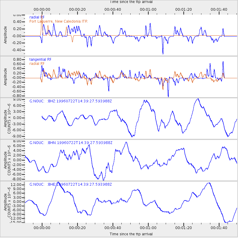
NOUC Port Laguerre, New Caledonia - Earthquake Result Viewer
*The percent match for this event was below the threshold and hence no stack was calculated.
| Earthquake location: |
Minahassa Peninsula, Sulawesi |
| Earthquake latitude/longitude: |
1.0/120.5 |
| Earthquake time(UTC): |
1996/07/22 (204) 14:31:05 GMT |
| Earthquake Depth: |
33 km |
| Earthquake Magnitude: |
5.6 MB |
| Earthquake Catalog/Contributor: |
WHDF/NEIC |
|
| Network: |
G GEOSCOPE |
| Station: |
NOUC Port Laguerre, New Caledonia |
| Lat/Lon: |
22.10 S/166.30 E |
| Elevation: |
112 m |
|
| Distance: |
50.3 deg |
| Az: |
120.095 deg |
| Baz: |
291.128 deg |
| Ray Param: |
$rayparam |
*The percent match for this event was below the threshold and hence was not used in the summary stack. |
|
| Radial Match: |
58.532585 % |
| Radial Bump: |
400 |
| Transverse Match: |
65.27677 % |
| Transverse Bump: |
295 |
| SOD ConfigId: |
4480 |
| Insert Time: |
2010-02-26 23:37:52.369 +0000 |
| GWidth: |
2.5 |
| Max Bumps: |
400 |
| Tol: |
0.001 |
|
Signal To Noise
| Channel | StoN | STA | LTA |
| G:NOUC: :BHN:19960722T14:39:27.593988Z | 4.5723343 | 4.727969E-6 | 1.0340384E-6 |
| G:NOUC: :BHE:19960722T14:39:27.593988Z | 1.4460666 | 8.316678E-6 | 5.751241E-6 |
| G:NOUC: :BHZ:19960722T14:39:27.593988Z | 1.1213449 | 1.9251802E-6 | 1.7168494E-6 |
| Arrivals |
| Ps | |
| PpPs | |
| PsPs/PpSs | |


