You are here: Home > Network List > G - GEOSCOPE Stations List
> Station NOUC Port Laguerre, New Caledonia > Earthquake Result Viewer
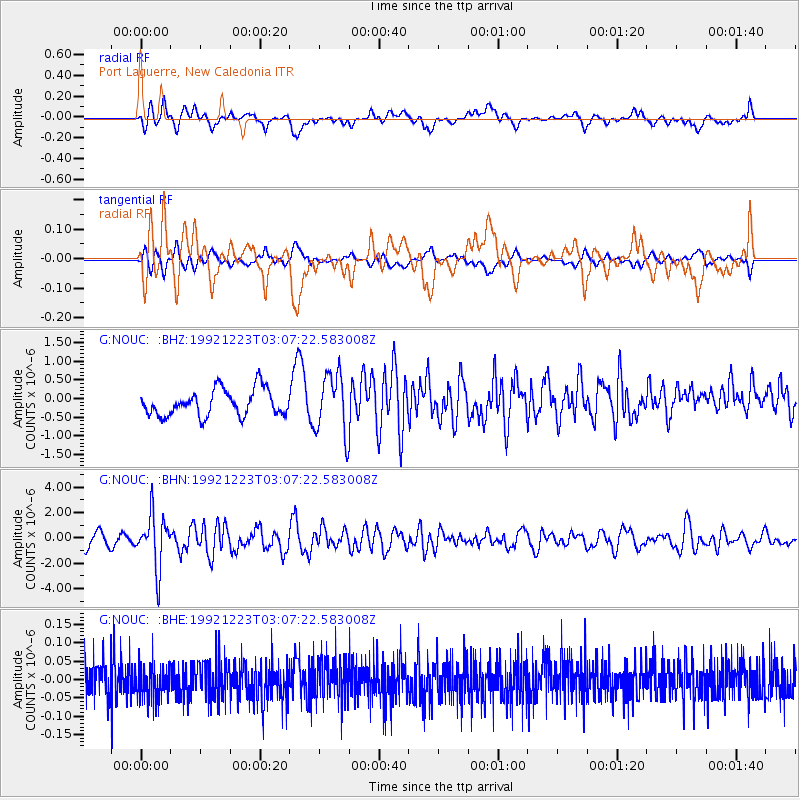
NOUC Port Laguerre, New Caledonia - Earthquake Result Viewer
*The percent match for this event was below the threshold and hence no stack was calculated.
| Earthquake location: |
Banda Sea |
| Earthquake latitude/longitude: |
-6.5/130.4 |
| Earthquake time(UTC): |
1992/12/23 (358) 03:00:45 GMT |
| Earthquake Depth: |
105 km |
| Earthquake Magnitude: |
5.9 MB |
| Earthquake Catalog/Contributor: |
WHDF/NEIC |
|
| Network: |
G GEOSCOPE |
| Station: |
NOUC Port Laguerre, New Caledonia |
| Lat/Lon: |
22.10 S/166.30 E |
| Elevation: |
112 m |
|
| Distance: |
38.0 deg |
| Az: |
117.815 deg |
| Baz: |
288.627 deg |
| Ray Param: |
$rayparam |
*The percent match for this event was below the threshold and hence was not used in the summary stack. |
|
| Radial Match: |
62.592407 % |
| Radial Bump: |
400 |
| Transverse Match: |
63.106216 % |
| Transverse Bump: |
400 |
| SOD ConfigId: |
4480 |
| Insert Time: |
2010-02-26 23:38:02.445 +0000 |
| GWidth: |
2.5 |
| Max Bumps: |
400 |
| Tol: |
0.001 |
|
Signal To Noise
| Channel | StoN | STA | LTA |
| G:NOUC: :BHN:19921223T03:07:22.583008Z | 3.7439334 | 2.0600064E-6 | 5.5022514E-7 |
| G:NOUC: :BHE:19921223T03:07:22.583008Z | 0.91939664 | 4.8952927E-8 | 5.3244623E-8 |
| G:NOUC: :BHZ:19921223T03:07:22.583008Z | 2.2929354 | 8.096036E-7 | 3.530861E-7 |
| Arrivals |
| Ps | |
| PpPs | |
| PsPs/PpSs | |


