You are here: Home > Network List > G - GEOSCOPE Stations List
> Station NOUC Port Laguerre, New Caledonia > Earthquake Result Viewer
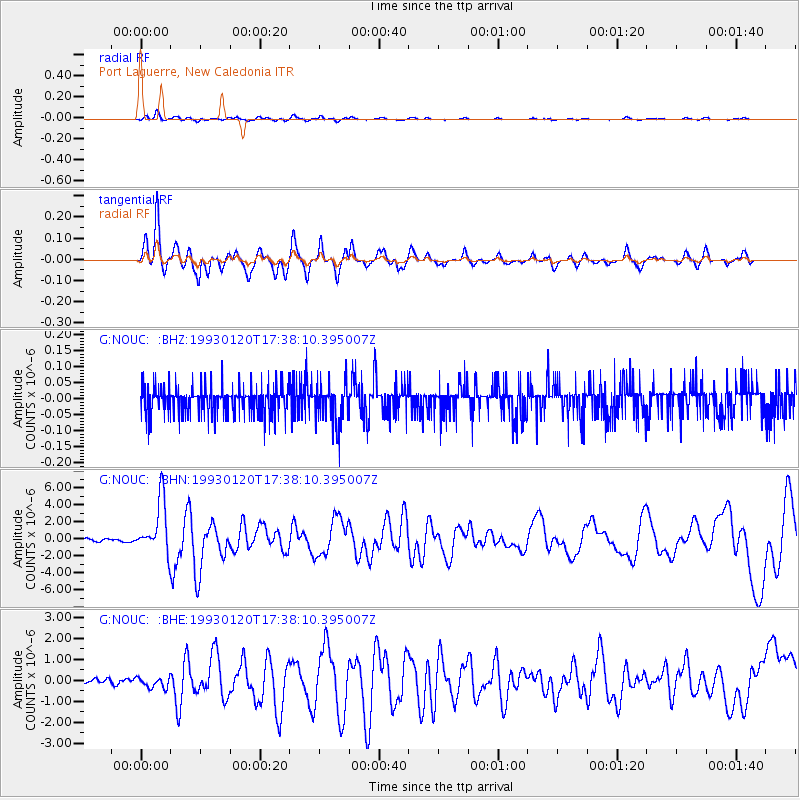
NOUC Port Laguerre, New Caledonia - Earthquake Result Viewer
*The percent match for this event was below the threshold and hence no stack was calculated.
| Earthquake location: |
Banda Sea |
| Earthquake latitude/longitude: |
-7.2/128.6 |
| Earthquake time(UTC): |
1993/01/20 (020) 17:31:15 GMT |
| Earthquake Depth: |
33 km |
| Earthquake Magnitude: |
6.0 MB, 6.3 MS |
| Earthquake Catalog/Contributor: |
WHDF/NEIC |
|
| Network: |
G GEOSCOPE |
| Station: |
NOUC Port Laguerre, New Caledonia |
| Lat/Lon: |
22.10 S/166.30 E |
| Elevation: |
112 m |
|
| Distance: |
39.2 deg |
| Az: |
116.218 deg |
| Baz: |
286.311 deg |
| Ray Param: |
$rayparam |
*The percent match for this event was below the threshold and hence was not used in the summary stack. |
|
| Radial Match: |
80.66132 % |
| Radial Bump: |
400 |
| Transverse Match: |
80.73481 % |
| Transverse Bump: |
400 |
| SOD ConfigId: |
4480 |
| Insert Time: |
2010-02-26 23:38:13.307 +0000 |
| GWidth: |
2.5 |
| Max Bumps: |
400 |
| Tol: |
0.001 |
|
Signal To Noise
| Channel | StoN | STA | LTA |
| G:NOUC: :BHN:19930120T17:38:10.395007Z | 18.892637 | 3.106016E-6 | 1.6440352E-7 |
| G:NOUC: :BHE:19930120T17:38:10.395007Z | 2.5367398 | 2.466592E-7 | 9.723473E-8 |
| G:NOUC: :BHZ:19930120T17:38:10.395007Z | 1.5582135 | 6.429561E-8 | 4.1262393E-8 |
| Arrivals |
| Ps | |
| PpPs | |
| PsPs/PpSs | |


