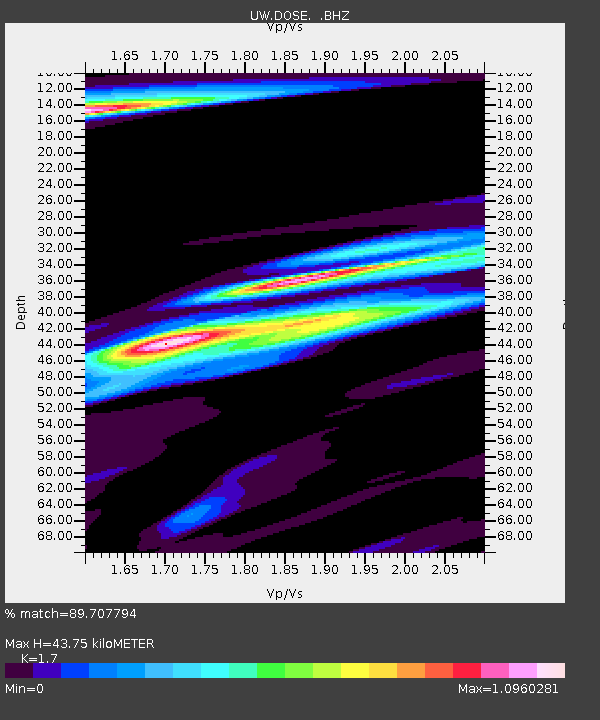
DOSE Dosewallips old TA.C04A, WA - Earthquake Result Viewer

Earthquake location: Near Coast Of Northern Chile
Earthquake latitude/longitude: -25.7/-70.6
Earthquake time(UTC): 2012/05/19 (140) 08:35:10 GMT
Earthquake Depth: 28 km
Earthquake Magnitude: 5.7 MB, 5.5 MS, 5.8 MW, 5.9 MW
Earthquake Catalog/Contributor: WHDF/NEIC
Network: UW Pacific Northwest Regional Seismic Network
Station: DOSE Dosewallips old TA.C04A, WA
Lat/Lon: 47.72 N/122.97 W
Elevation: 53 m
Distance: 87.0 deg
Az: 327.6 deg
Baz: 134.296 deg
Ray Param: 0.043640096
Estimated Moho Depth: 43.75 km
Estimated Crust Vp/Vs: 1.70
Assumed Crust Vp: 6.566 km/s
Estimated Crust Vs: 3.862 km/s
Estimated Crust Poisson's Ratio: 0.24
Radial Match: 89.707794 %
Radial Bump: 367
Transverse Match: 80.445305 %
Transverse Bump: 400
SOD ConfigId: 446234
Insert Time: 2012-08-09 00:45:39.286 +0000
GWidth: 2.5
Max Bumps: 400
Tol: 0.001

Signal To Noise

ChannelStoNSTALTA
UW:DOSE: :BHZ:20120519T08:47:21.749988Z6.25759124.2557846E-76.8009946E-8
UW:DOSE: :BHN:20120519T08:47:21.749988Z3.5554771.8711918E-75.2628433E-8
UW:DOSE: :BHE:20120519T08:47:21.749988Z4.62706232.1672778E-74.6839176E-8
Arrivals
Ps4.8 SECOND
PpPs18 SECOND
PsPs/PpSs22 SECOND