You are here: Home > Network List > G - GEOSCOPE Stations List
> Station NOUC Port Laguerre, New Caledonia > Earthquake Result Viewer
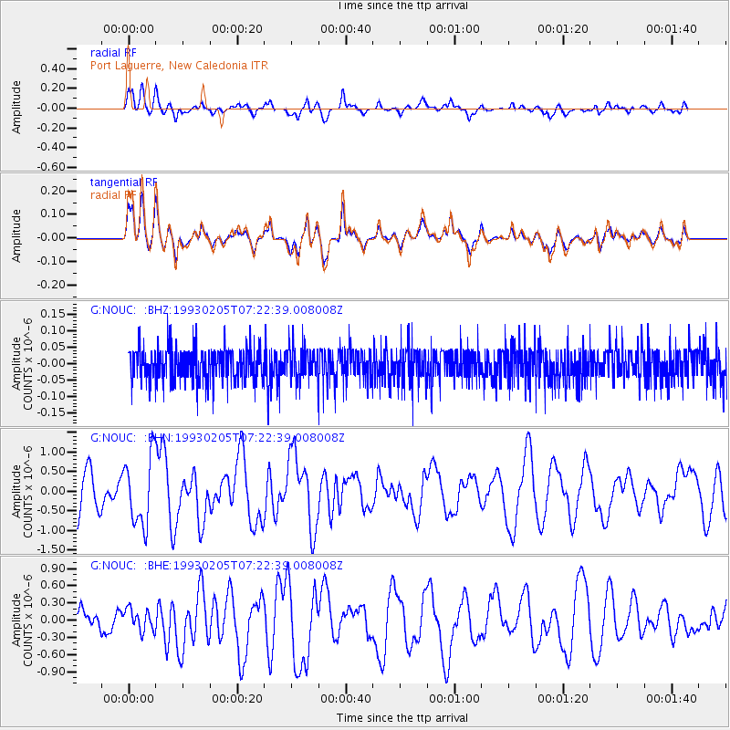
NOUC Port Laguerre, New Caledonia - Earthquake Result Viewer
*The percent match for this event was below the threshold and hence no stack was calculated.
| Earthquake location: |
South Of Mariana Islands |
| Earthquake latitude/longitude: |
12.5/141.9 |
| Earthquake time(UTC): |
1993/02/05 (036) 07:15:21 GMT |
| Earthquake Depth: |
33 km |
| Earthquake Magnitude: |
5.5 MB, 5.7 MS |
| Earthquake Catalog/Contributor: |
WHDF/NEIC |
|
| Network: |
G GEOSCOPE |
| Station: |
NOUC Port Laguerre, New Caledonia |
| Lat/Lon: |
22.10 S/166.30 E |
| Elevation: |
112 m |
|
| Distance: |
42.0 deg |
| Az: |
144.975 deg |
| Baz: |
322.823 deg |
| Ray Param: |
$rayparam |
*The percent match for this event was below the threshold and hence was not used in the summary stack. |
|
| Radial Match: |
58.29239 % |
| Radial Bump: |
400 |
| Transverse Match: |
57.407272 % |
| Transverse Bump: |
400 |
| SOD ConfigId: |
4480 |
| Insert Time: |
2010-02-26 23:38:16.053 +0000 |
| GWidth: |
2.5 |
| Max Bumps: |
400 |
| Tol: |
0.001 |
|
Signal To Noise
| Channel | StoN | STA | LTA |
| G:NOUC: :BHN:19930205T07:22:39.008008Z | 1.8599026 | 8.859456E-7 | 4.7633978E-7 |
| G:NOUC: :BHE:19930205T07:22:39.008008Z | 0.44718075 | 1.8961876E-7 | 4.2403158E-7 |
| G:NOUC: :BHZ:19930205T07:22:39.008008Z | 0.94482833 | 4.7324384E-8 | 5.0087813E-8 |
| Arrivals |
| Ps | |
| PpPs | |
| PsPs/PpSs | |


