You are here: Home > Network List > G - GEOSCOPE Stations List
> Station NOUC Port Laguerre, New Caledonia > Earthquake Result Viewer
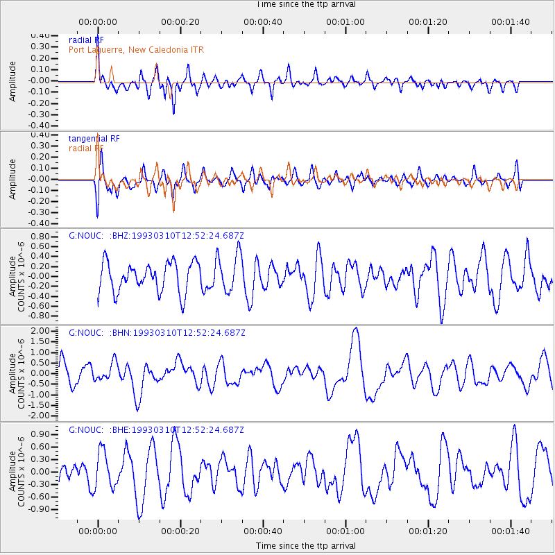
NOUC Port Laguerre, New Caledonia - Earthquake Result Viewer
*The percent match for this event was below the threshold and hence no stack was calculated.
| Earthquake location: |
South Sandwich Islands Region |
| Earthquake latitude/longitude: |
-59.7/-25.7 |
| Earthquake time(UTC): |
1993/03/10 (069) 12:39:23 GMT |
| Earthquake Depth: |
33 km |
| Earthquake Magnitude: |
5.4 MB, 6.4 MS |
| Earthquake Catalog/Contributor: |
WHDF/NEIC |
|
| Network: |
G GEOSCOPE |
| Station: |
NOUC Port Laguerre, New Caledonia |
| Lat/Lon: |
22.10 S/166.30 E |
| Elevation: |
112 m |
|
| Distance: |
97.9 deg |
| Az: |
191.265 deg |
| Baz: |
173.865 deg |
| Ray Param: |
$rayparam |
*The percent match for this event was below the threshold and hence was not used in the summary stack. |
|
| Radial Match: |
59.50498 % |
| Radial Bump: |
400 |
| Transverse Match: |
61.491795 % |
| Transverse Bump: |
400 |
| SOD ConfigId: |
4480 |
| Insert Time: |
2010-02-26 23:38:17.096 +0000 |
| GWidth: |
2.5 |
| Max Bumps: |
400 |
| Tol: |
0.001 |
|
Signal To Noise
| Channel | StoN | STA | LTA |
| G:NOUC: :BHN:19930310T12:52:24.687Z | 1.0185615 | 4.4557729E-7 | 4.374574E-7 |
| G:NOUC: :BHE:19930310T12:52:24.687Z | 2.4949968 | 4.4298412E-7 | 1.7754897E-7 |
| G:NOUC: :BHZ:19930310T12:52:24.687Z | 1.325245 | 3.9028708E-7 | 2.9450183E-7 |
| Arrivals |
| Ps | |
| PpPs | |
| PsPs/PpSs | |


