You are here: Home > Network List > G - GEOSCOPE Stations List
> Station NOUC Port Laguerre, New Caledonia > Earthquake Result Viewer
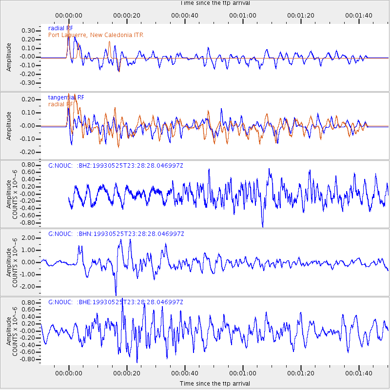
NOUC Port Laguerre, New Caledonia - Earthquake Result Viewer
*The percent match for this event was below the threshold and hence no stack was calculated.
| Earthquake location: |
Alaska Peninsula |
| Earthquake latitude/longitude: |
55.0/-160.5 |
| Earthquake time(UTC): |
1993/05/25 (145) 23:16:43 GMT |
| Earthquake Depth: |
33 km |
| Earthquake Magnitude: |
6.2 MB, 5.8 MS, 6.3 ML |
| Earthquake Catalog/Contributor: |
WHDF/NEIC |
|
| Network: |
G GEOSCOPE |
| Station: |
NOUC Port Laguerre, New Caledonia |
| Lat/Lon: |
22.10 S/166.30 E |
| Elevation: |
112 m |
|
| Distance: |
81.9 deg |
| Az: |
210.875 deg |
| Baz: |
18.575 deg |
| Ray Param: |
$rayparam |
*The percent match for this event was below the threshold and hence was not used in the summary stack. |
|
| Radial Match: |
80.785324 % |
| Radial Bump: |
400 |
| Transverse Match: |
57.507282 % |
| Transverse Bump: |
400 |
| SOD ConfigId: |
4480 |
| Insert Time: |
2010-02-26 23:38:21.045 +0000 |
| GWidth: |
2.5 |
| Max Bumps: |
400 |
| Tol: |
0.001 |
|
Signal To Noise
| Channel | StoN | STA | LTA |
| G:NOUC: :BHN:19930525T23:28:28.046997Z | 2.5289302 | 5.7398927E-7 | 2.2696919E-7 |
| G:NOUC: :BHE:19930525T23:28:28.046997Z | 1.1524088 | 1.956386E-7 | 1.6976492E-7 |
| G:NOUC: :BHZ:19930525T23:28:28.046997Z | 0.8062402 | 1.4514765E-7 | 1.800303E-7 |
| Arrivals |
| Ps | |
| PpPs | |
| PsPs/PpSs | |


