You are here: Home > Network List > G - GEOSCOPE Stations List
> Station PPTF Pamatai - Papeete - Tahiti island - French Polynesia, France > Earthquake Result Viewer
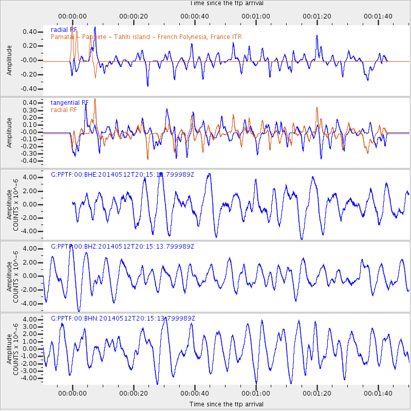
PPTF Pamatai - Papeete - Tahiti island - French Polynesia, France - Earthquake Result Viewer
*The percent match for this event was below the threshold and hence no stack was calculated.
| Earthquake location: |
Southern East Pacific Rise |
| Earthquake latitude/longitude: |
-49.7/-115.3 |
| Earthquake time(UTC): |
2014/05/12 (132) 20:07:51 GMT |
| Earthquake Depth: |
10 km |
| Earthquake Magnitude: |
5.4 MW |
| Earthquake Catalog/Contributor: |
ISC/ISC |
|
| Network: |
G GEOSCOPE |
| Station: |
PPTF Pamatai - Papeete - Tahiti island - French Polynesia, France |
| Lat/Lon: |
17.59 S/149.57 W |
| Elevation: |
705 m |
|
| Distance: |
42.2 deg |
| Az: |
306.995 deg |
| Baz: |
147.027 deg |
| Ray Param: |
$rayparam |
*The percent match for this event was below the threshold and hence was not used in the summary stack. |
|
| Radial Match: |
62.738117 % |
| Radial Bump: |
400 |
| Transverse Match: |
54.857872 % |
| Transverse Bump: |
384 |
| SOD ConfigId: |
3390531 |
| Insert Time: |
2019-04-11 20:22:35.513 +0000 |
| GWidth: |
2.5 |
| Max Bumps: |
400 |
| Tol: |
0.001 |
|
Signal To Noise
| Channel | StoN | STA | LTA |
| G:PPTF:00:BHZ:20140512T20:15:13.799989Z | 2.6489794 | 3.38993E-6 | 1.2797117E-6 |
| G:PPTF:00:BHN:20140512T20:15:13.799989Z | 1.4238567 | 1.7645629E-6 | 1.2392841E-6 |
| G:PPTF:00:BHE:20140512T20:15:13.799989Z | 1.782179 | 2.7747685E-6 | 1.5569528E-6 |
| Arrivals |
| Ps | |
| PpPs | |
| PsPs/PpSs | |


