You are here: Home > Network List > G - GEOSCOPE Stations List
> Station NOUC Port Laguerre, New Caledonia > Earthquake Result Viewer
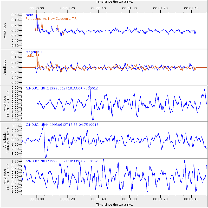
NOUC Port Laguerre, New Caledonia - Earthquake Result Viewer
*The percent match for this event was below the threshold and hence no stack was calculated.
| Earthquake location: |
Irian Jaya Region, Indonesia |
| Earthquake latitude/longitude: |
-4.4/135.1 |
| Earthquake time(UTC): |
1993/06/12 (163) 18:26:45 GMT |
| Earthquake Depth: |
33 km |
| Earthquake Magnitude: |
5.8 MB, 6.1 MS, 6.2 UNKNOWN, 6.2 MW |
| Earthquake Catalog/Contributor: |
WHDF/NEIC |
|
| Network: |
G GEOSCOPE |
| Station: |
NOUC Port Laguerre, New Caledonia |
| Lat/Lon: |
22.10 S/166.30 E |
| Elevation: |
112 m |
|
| Distance: |
35.0 deg |
| Az: |
123.034 deg |
| Baz: |
295.661 deg |
| Ray Param: |
$rayparam |
*The percent match for this event was below the threshold and hence was not used in the summary stack. |
|
| Radial Match: |
69.81282 % |
| Radial Bump: |
361 |
| Transverse Match: |
65.59112 % |
| Transverse Bump: |
400 |
| SOD ConfigId: |
4480 |
| Insert Time: |
2010-02-26 23:38:23.032 +0000 |
| GWidth: |
2.5 |
| Max Bumps: |
400 |
| Tol: |
0.001 |
|
Signal To Noise
| Channel | StoN | STA | LTA |
| G:NOUC: :BHN:19930612T18:33:04.751001Z | 4.2437935 | 1.5559921E-6 | 3.6665122E-7 |
| G:NOUC: :BHE:19930612T18:33:04.753015Z | 0.6143345 | 2.7195713E-7 | 4.4268575E-7 |
| G:NOUC: :BHZ:19930612T18:33:04.751001Z | 2.464845 | 9.307208E-7 | 3.775981E-7 |
| Arrivals |
| Ps | |
| PpPs | |
| PsPs/PpSs | |


