You are here: Home > Network List > TA - USArray Transportable Network (new EarthScope stations) Stations List
> Station P56A Dayton Farm, Ripley, WV, USA > Earthquake Result Viewer
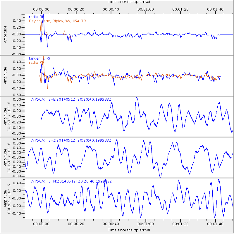
P56A Dayton Farm, Ripley, WV, USA - Earthquake Result Viewer
*The percent match for this event was below the threshold and hence no stack was calculated.
| Earthquake location: |
Southern East Pacific Rise |
| Earthquake latitude/longitude: |
-49.7/-115.3 |
| Earthquake time(UTC): |
2014/05/12 (132) 20:07:51 GMT |
| Earthquake Depth: |
10 km |
| Earthquake Magnitude: |
5.4 MW |
| Earthquake Catalog/Contributor: |
ISC/ISC |
|
| Network: |
TA USArray Transportable Network (new EarthScope stations) |
| Station: |
P56A Dayton Farm, Ripley, WV, USA |
| Lat/Lon: |
39.50 N/78.84 W |
| Elevation: |
249 m |
|
| Distance: |
94.4 deg |
| Az: |
27.492 deg |
| Baz: |
202.818 deg |
| Ray Param: |
$rayparam |
*The percent match for this event was below the threshold and hence was not used in the summary stack. |
|
| Radial Match: |
74.88953 % |
| Radial Bump: |
400 |
| Transverse Match: |
69.67756 % |
| Transverse Bump: |
400 |
| SOD ConfigId: |
3390531 |
| Insert Time: |
2019-04-11 20:24:56.093 +0000 |
| GWidth: |
2.5 |
| Max Bumps: |
400 |
| Tol: |
0.001 |
|
Signal To Noise
| Channel | StoN | STA | LTA |
| TA:P56A: :BHZ:20140512T20:20:40.199983Z | 1.1989608 | 2.8694112E-7 | 2.3932486E-7 |
| TA:P56A: :BHN:20140512T20:20:40.199983Z | 1.0213051 | 2.3330601E-7 | 2.2843909E-7 |
| TA:P56A: :BHE:20140512T20:20:40.199983Z | 1.4653662 | 2.8612118E-7 | 1.9525575E-7 |
| Arrivals |
| Ps | |
| PpPs | |
| PsPs/PpSs | |


